You are here: Home > Network List > TA - USArray Transportable Network (new EarthScope stations) Stations List
> Station J05D Fort Rock, OR, USA > Earthquake Result Viewer
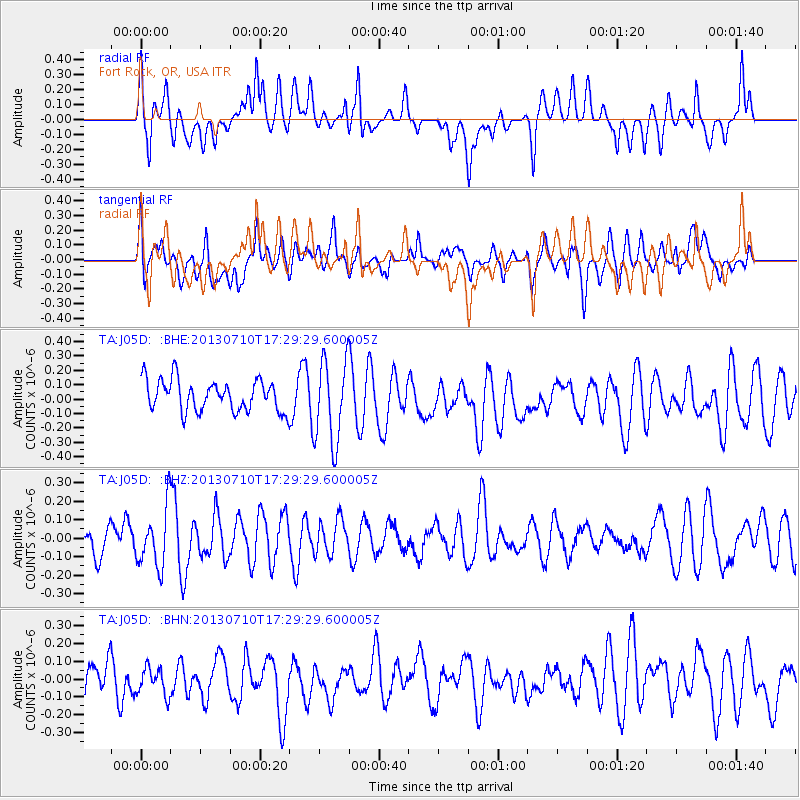
J05D Fort Rock, OR, USA - Earthquake Result Viewer
*The percent match for this event was below the threshold and hence no stack was calculated.
| Earthquake location: |
Bismarck Sea |
| Earthquake latitude/longitude: |
-5.0/148.9 |
| Earthquake time(UTC): |
2013/07/10 (191) 17:16:46 GMT |
| Earthquake Depth: |
12 km |
| Earthquake Magnitude: |
5.5 MW |
| Earthquake Catalog/Contributor: |
NEIC PDE/NEIC PDE-W |
|
| Network: |
TA USArray Transportable Network (new EarthScope stations) |
| Station: |
J05D Fort Rock, OR, USA |
| Lat/Lon: |
43.28 N/121.23 W |
| Elevation: |
1541 m |
|
| Distance: |
93.3 deg |
| Az: |
47.008 deg |
| Baz: |
266.331 deg |
| Ray Param: |
$rayparam |
*The percent match for this event was below the threshold and hence was not used in the summary stack. |
|
| Radial Match: |
59.996635 % |
| Radial Bump: |
400 |
| Transverse Match: |
52.332962 % |
| Transverse Bump: |
400 |
| SOD ConfigId: |
512894 |
| Insert Time: |
2013-09-15 18:51:03.443 +0000 |
| GWidth: |
2.5 |
| Max Bumps: |
400 |
| Tol: |
0.001 |
|
Signal To Noise
| Channel | StoN | STA | LTA |
| TA:J05D: :BHZ:20130710T17:29:29.600005Z | 1.297429 | 1.5877511E-7 | 1.2237672E-7 |
| TA:J05D: :BHN:20130710T17:29:29.600005Z | 0.70563364 | 9.042128E-8 | 1.2814198E-7 |
| TA:J05D: :BHE:20130710T17:29:29.600005Z | 2.7115266 | 2.9175288E-7 | 1.07597266E-7 |
| Arrivals |
| Ps | |
| PpPs | |
| PsPs/PpSs | |


