You are here: Home > Network List > TA - USArray Transportable Network (new EarthScope stations) Stations List
> Station S44A Carbondale, IL, USA > Earthquake Result Viewer
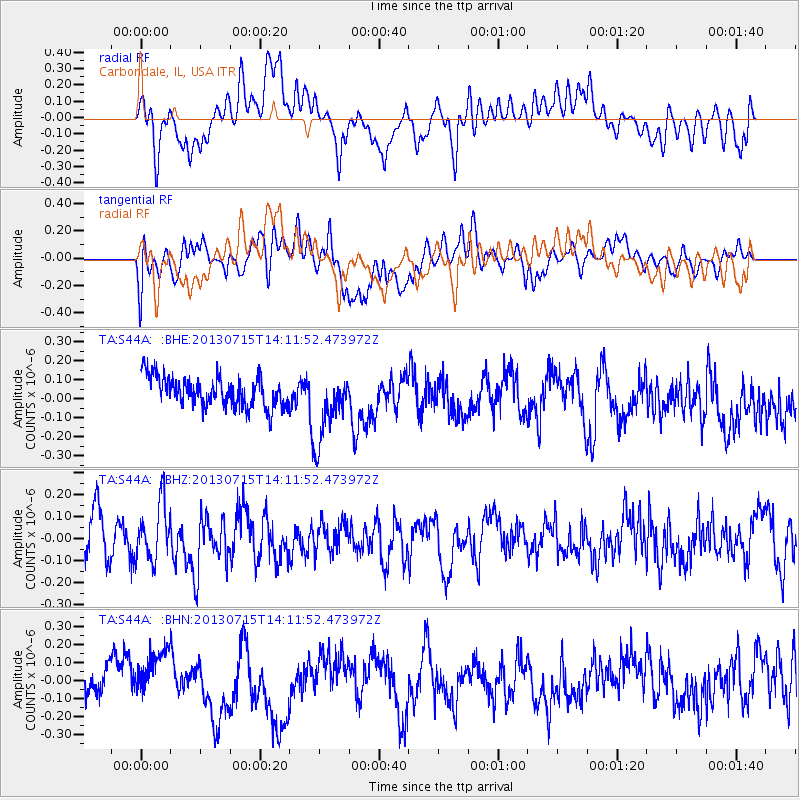
S44A Carbondale, IL, USA - Earthquake Result Viewer
*The percent match for this event was below the threshold and hence no stack was calculated.
| Earthquake location: |
Tonga Islands |
| Earthquake latitude/longitude: |
-15.4/-173.1 |
| Earthquake time(UTC): |
2013/07/15 (196) 13:59:04 GMT |
| Earthquake Depth: |
15 km |
| Earthquake Magnitude: |
5.8 MW, 5.5 MB, 5.8 MW |
| Earthquake Catalog/Contributor: |
NEIC PDE/NEIC PDE-W |
|
| Network: |
TA USArray Transportable Network (new EarthScope stations) |
| Station: |
S44A Carbondale, IL, USA |
| Lat/Lon: |
37.69 N/89.26 W |
| Elevation: |
155 m |
|
| Distance: |
94.5 deg |
| Az: |
52.291 deg |
| Baz: |
254.143 deg |
| Ray Param: |
$rayparam |
*The percent match for this event was below the threshold and hence was not used in the summary stack. |
|
| Radial Match: |
53.129715 % |
| Radial Bump: |
400 |
| Transverse Match: |
49.88895 % |
| Transverse Bump: |
400 |
| SOD ConfigId: |
512894 |
| Insert Time: |
2013-09-15 19:18:44.962 +0000 |
| GWidth: |
2.5 |
| Max Bumps: |
400 |
| Tol: |
0.001 |
|
Signal To Noise
| Channel | StoN | STA | LTA |
| TA:S44A: :BHZ:20130715T14:11:52.473972Z | 1.464863 | 1.2638472E-7 | 8.62775E-8 |
| TA:S44A: :BHN:20130715T14:11:52.473972Z | 1.7695606 | 1.5462099E-7 | 8.737819E-8 |
| TA:S44A: :BHE:20130715T14:11:52.473972Z | 2.3321843 | 1.8496776E-7 | 7.931096E-8 |
| Arrivals |
| Ps | |
| PpPs | |
| PsPs/PpSs | |


