You are here: Home > Network List > US - United States National Seismic Network Stations List
> Station AMTX Amarillo, Texas, USA > Earthquake Result Viewer
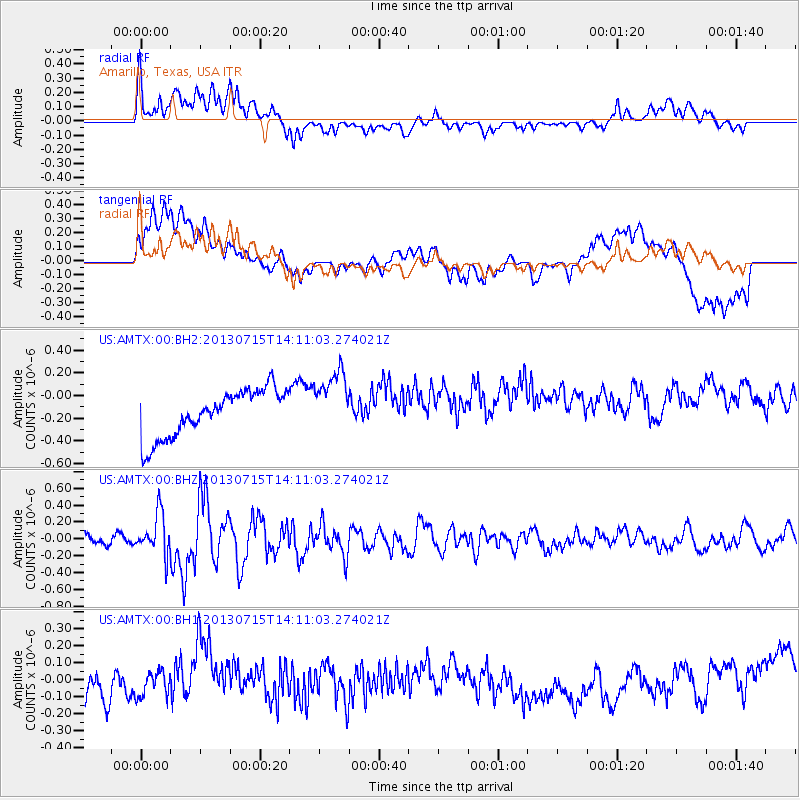
AMTX Amarillo, Texas, USA - Earthquake Result Viewer
*The percent match for this event was below the threshold and hence no stack was calculated.
| Earthquake location: |
Tonga Islands |
| Earthquake latitude/longitude: |
-15.4/-173.1 |
| Earthquake time(UTC): |
2013/07/15 (196) 13:59:04 GMT |
| Earthquake Depth: |
15 km |
| Earthquake Magnitude: |
5.8 MW, 5.5 MB, 5.8 MW |
| Earthquake Catalog/Contributor: |
NEIC PDE/NEIC PDE-W |
|
| Network: |
US United States National Seismic Network |
| Station: |
AMTX Amarillo, Texas, USA |
| Lat/Lon: |
34.53 N/101.41 W |
| Elevation: |
1010 m |
|
| Distance: |
84.2 deg |
| Az: |
51.982 deg |
| Baz: |
246.988 deg |
| Ray Param: |
$rayparam |
*The percent match for this event was below the threshold and hence was not used in the summary stack. |
|
| Radial Match: |
60.948246 % |
| Radial Bump: |
400 |
| Transverse Match: |
41.702 % |
| Transverse Bump: |
400 |
| SOD ConfigId: |
512894 |
| Insert Time: |
2013-09-15 19:21:41.191 +0000 |
| GWidth: |
2.5 |
| Max Bumps: |
400 |
| Tol: |
0.001 |
|
Signal To Noise
| Channel | StoN | STA | LTA |
| US:AMTX:00:BHZ:20130715T14:11:03.274021Z | 3.6337485 | 2.429087E-7 | 6.684797E-8 |
| US:AMTX:00:BH1:20130715T14:11:03.274021Z | 0.4244586 | 1.0429806E-7 | 2.4572023E-7 |
| US:AMTX:00:BH2:20130715T14:11:03.274021Z | 1.3396533 | 2.7325507E-7 | 2.0397447E-7 |
| Arrivals |
| Ps | |
| PpPs | |
| PsPs/PpSs | |


