You are here: Home > Network List > US - United States National Seismic Network Stations List
> Station HAWA Hanford, Washington, USA > Earthquake Result Viewer
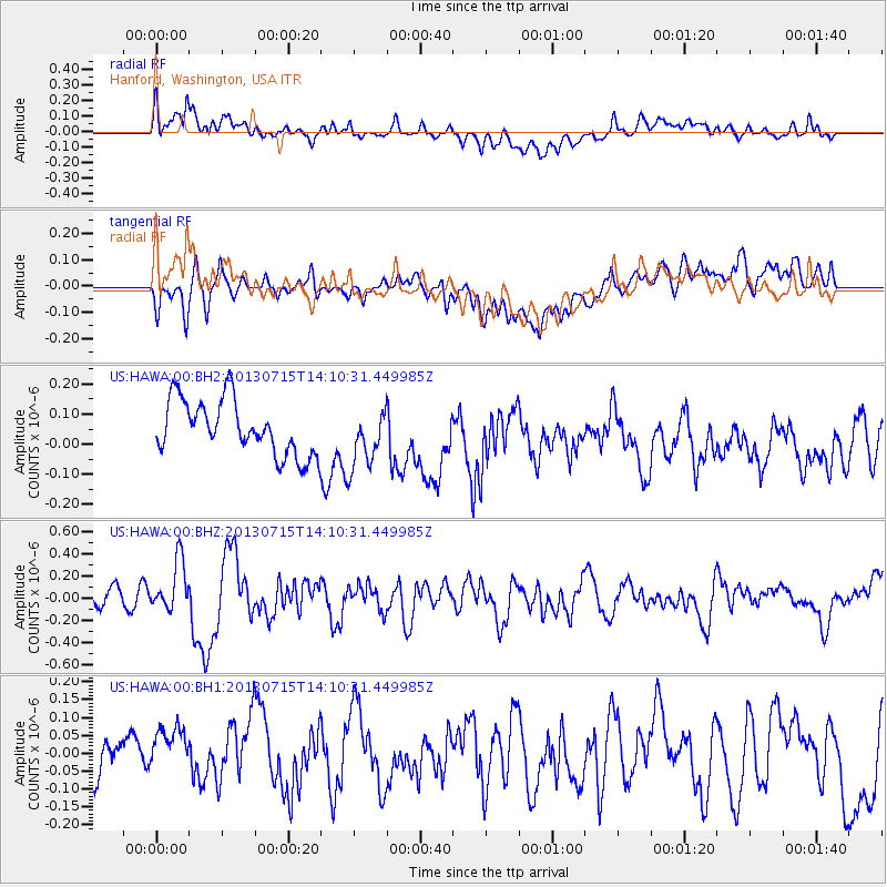
HAWA Hanford, Washington, USA - Earthquake Result Viewer
*The percent match for this event was below the threshold and hence no stack was calculated.
| Earthquake location: |
Tonga Islands |
| Earthquake latitude/longitude: |
-15.4/-173.1 |
| Earthquake time(UTC): |
2013/07/15 (196) 13:59:04 GMT |
| Earthquake Depth: |
15 km |
| Earthquake Magnitude: |
5.8 MW, 5.5 MB, 5.8 MW |
| Earthquake Catalog/Contributor: |
NEIC PDE/NEIC PDE-W |
|
| Network: |
US United States National Seismic Network |
| Station: |
HAWA Hanford, Washington, USA |
| Lat/Lon: |
46.39 N/119.53 W |
| Elevation: |
364 m |
|
| Distance: |
78.1 deg |
| Az: |
34.681 deg |
| Baz: |
232.464 deg |
| Ray Param: |
$rayparam |
*The percent match for this event was below the threshold and hence was not used in the summary stack. |
|
| Radial Match: |
66.21857 % |
| Radial Bump: |
400 |
| Transverse Match: |
57.01095 % |
| Transverse Bump: |
400 |
| SOD ConfigId: |
512894 |
| Insert Time: |
2013-09-15 19:22:21.092 +0000 |
| GWidth: |
2.5 |
| Max Bumps: |
400 |
| Tol: |
0.001 |
|
Signal To Noise
| Channel | StoN | STA | LTA |
| US:HAWA:00:BHZ:20130715T14:10:31.449985Z | 3.7677479 | 2.2855431E-7 | 6.0660724E-8 |
| US:HAWA:00:BH1:20130715T14:10:31.449985Z | 1.3908068 | 7.312081E-8 | 5.2574386E-8 |
| US:HAWA:00:BH2:20130715T14:10:31.449985Z | 1.0665643 | 9.619783E-8 | 9.019412E-8 |
| Arrivals |
| Ps | |
| PpPs | |
| PsPs/PpSs | |


