You are here: Home > Network List > WY - Yellowstone Wyoming Seismic Network Stations List
> Station YHH Holmes Hill, YNP, WY, USA > Earthquake Result Viewer
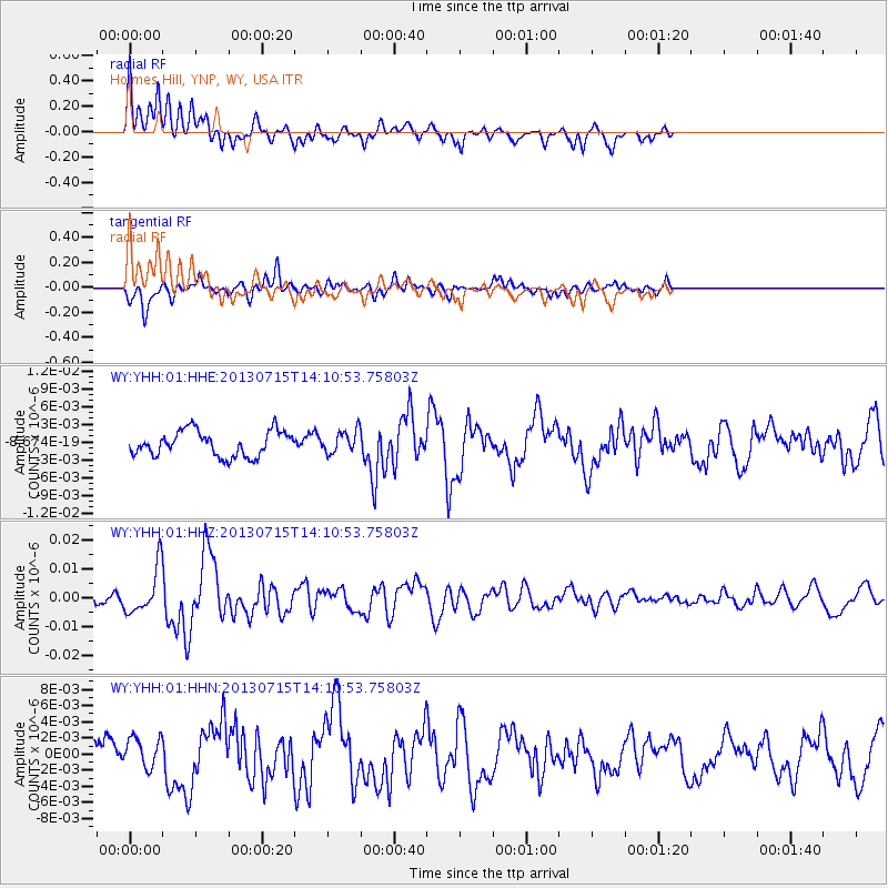
YHH Holmes Hill, YNP, WY, USA - Earthquake Result Viewer
*The percent match for this event was below the threshold and hence no stack was calculated.
| Earthquake location: |
Tonga Islands |
| Earthquake latitude/longitude: |
-15.4/-173.1 |
| Earthquake time(UTC): |
2013/07/15 (196) 13:59:04 GMT |
| Earthquake Depth: |
15 km |
| Earthquake Magnitude: |
5.8 MW, 5.5 MB, 5.8 MW |
| Earthquake Catalog/Contributor: |
NEIC PDE/NEIC PDE-W |
|
| Network: |
WY Yellowstone Wyoming Seismic Network |
| Station: |
YHH Holmes Hill, YNP, WY, USA |
| Lat/Lon: |
44.79 N/110.85 W |
| Elevation: |
2717 m |
|
| Distance: |
82.3 deg |
| Az: |
39.487 deg |
| Baz: |
239.472 deg |
| Ray Param: |
$rayparam |
*The percent match for this event was below the threshold and hence was not used in the summary stack. |
|
| Radial Match: |
78.559555 % |
| Radial Bump: |
400 |
| Transverse Match: |
68.16152 % |
| Transverse Bump: |
400 |
| SOD ConfigId: |
512894 |
| Insert Time: |
2013-09-15 19:25:55.271 +0000 |
| GWidth: |
2.5 |
| Max Bumps: |
400 |
| Tol: |
0.001 |
|
Signal To Noise
| Channel | StoN | STA | LTA |
| WY:YHH:01:HHZ:20130715T14:10:53.75803Z | 3.6192763 | 7.831591E-9 | 2.1638558E-9 |
| WY:YHH:01:HHN:20130715T14:10:53.75803Z | 1.093753 | 1.890309E-9 | 1.7282777E-9 |
| WY:YHH:01:HHE:20130715T14:10:53.75803Z | 0.8716437 | 1.8493698E-9 | 2.1217037E-9 |
| Arrivals |
| Ps | |
| PpPs | |
| PsPs/PpSs | |


