GO02 Mina Guanaco, Chile - Earthquake Result Viewer
Earthquake location: South Sandwich Islands Region
Earthquake latitude/longitude: -60.9/-25.1
Earthquake time(UTC): 2013/07/15 (196) 14:03:39 GMT
Earthquake Depth: 11 km
Earthquake Magnitude: 7.3 MW, 6.5 MB, 7.1 MS, 7.3 MW
Earthquake Catalog/Contributor: NEIC PDE/NEIC PDE-W
Network: C Chilean National Seismic Network
Station: GO02 Mina Guanaco, Chile
Lat/Lon: 25.16 S/69.59 W
Elevation: 2556 m
Distance: 46.8 deg
Az: 299.291 deg
Baz: 151.895 deg
Ray Param: 0.07043588
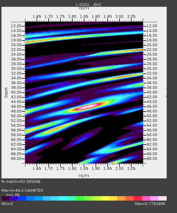
Estimated Moho Depth: 46.0 km
Estimated Crust Vp/Vs: 1.86
Assumed Crust Vp: 6.475 km/s
Estimated Crust Vs: 3.481 km/s
Estimated Crust Poisson's Ratio: 0.30
Radial Match: 92.385086 %
Radial Bump: 400
Transverse Match: 84.32481 %
Transverse Bump: 400
SOD ConfigId: 512894
Insert Time: 2013-09-15 19:28:06.899 +0000
GWidth: 2.5
Max Bumps: 400
Tol: 0.001

Signal To Noise

ChannelStoNSTALTA
C:GO02: :BHZ:20130715T14:11:38.200007Z4.54731561.6227184E-63.5685193E-7
C:GO02: :BHN:20130715T14:11:38.200007Z1.73205587.700625E-74.445945E-7
C:GO02: :BHE:20130715T14:11:38.200007Z1.96743748.9158675E-74.5317162E-7
Arrivals
Ps6.5 SECOND
PpPs19 SECOND
PsPs/PpSs26 SECOND