TAM Tamanrasset, Algeria - Earthquake Result Viewer
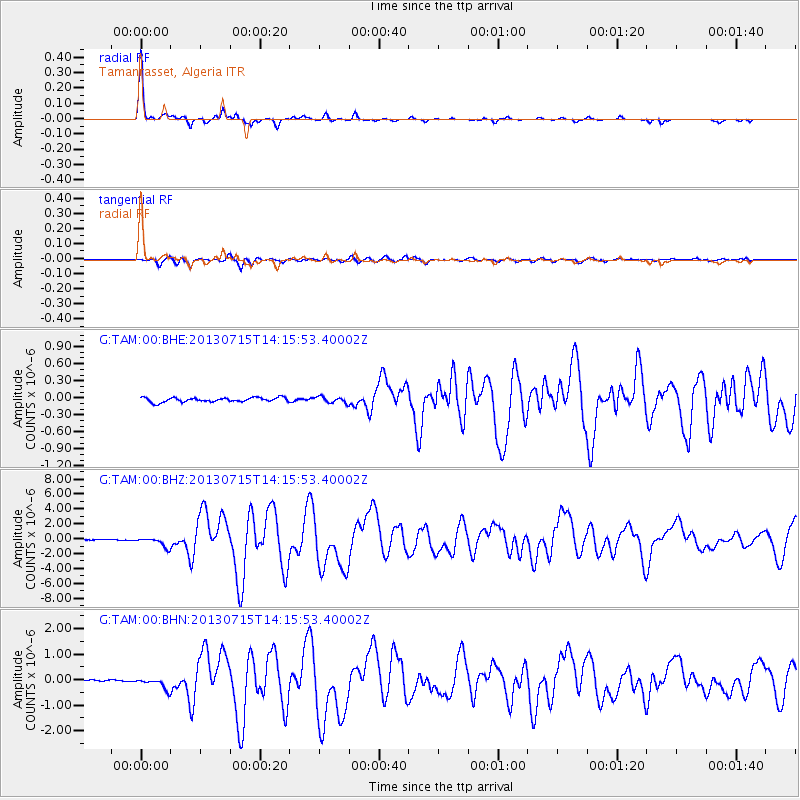
Earthquake location: South Sandwich Islands Region
Earthquake latitude/longitude: -60.9/-25.1
Earthquake time(UTC): 2013/07/15 (196) 14:03:39 GMT
Earthquake Depth: 11 km
Earthquake Magnitude: 7.3 MW, 6.5 MB, 7.1 MS, 7.3 MW
Earthquake Catalog/Contributor: NEIC PDE/NEIC PDE-W
Network: G GEOSCOPE
Station: TAM Tamanrasset, Algeria
Lat/Lon: 22.79 N/5.53 E
Elevation: 1377 m
Distance: 87.0 deg
Az: 28.059 deg
Baz: 194.448 deg
Ray Param: 0.043665957
Estimated Moho Depth: 31.0 km
Estimated Crust Vp/Vs: 2.03
Assumed Crust Vp: 6.61 km/s
Estimated Crust Vs: 3.264 km/s
Estimated Crust Poisson's Ratio: 0.34
Radial Match: 98.029144 %
Radial Bump: 221
Transverse Match: 90.19871 %
Transverse Bump: 400
SOD ConfigId: 512894
Insert Time: 2013-09-15 19:29:33.582 +0000
GWidth: 2.5
Max Bumps: 400
Tol: 0.001

Signal To Noise

ChannelStoNSTALTA
G:TAM:00:BHZ:20130715T14:15:53.40002Z12.7805596.5079513E-75.092071E-8
G:TAM:00:BHN:20130715T14:15:53.40002Z6.2574452.324926E-73.7154557E-8
G:TAM:00:BHE:20130715T14:15:53.40002Z1.44427315.5033304E-83.81045E-8
Arrivals
Ps4.9 SECOND
PpPs14 SECOND
PsPs/PpSs19 SECOND