
BOSA Boshof, South Africa - Earthquake Result Viewer
| ||||||||||||||||||
| ||||||||||||||||||
| ||||||||||||||||||
|
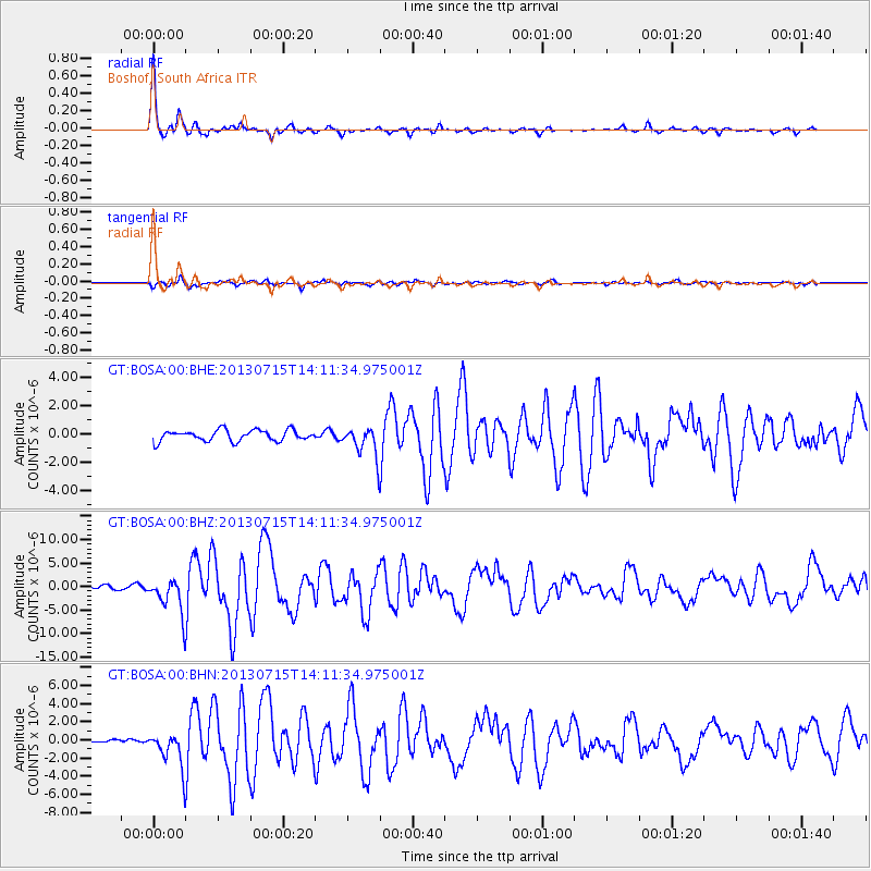
Signal To Noise
| Channel | StoN | STA | LTA |
| GT:BOSA:00:BHZ:20130715T14:11:34.975001Z | 6.6006117 | 3.706276E-6 | 5.615049E-7 |
| GT:BOSA:00:BHN:20130715T14:11:34.975001Z | 5.4745545 | 1.9065178E-6 | 3.4825078E-7 |
| GT:BOSA:00:BHE:20130715T14:11:34.975001Z | 2.6890197 | 1.024938E-6 | 3.8115678E-7 |
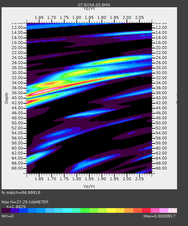
| Arrivals | |
| Ps | 4.1 SECOND |
| PpPs | 14 SECOND |
| PsPs/PpSs | 18 SECOND |

