ABPO Ambohimpanompo, Madagascar - Earthquake Result Viewer
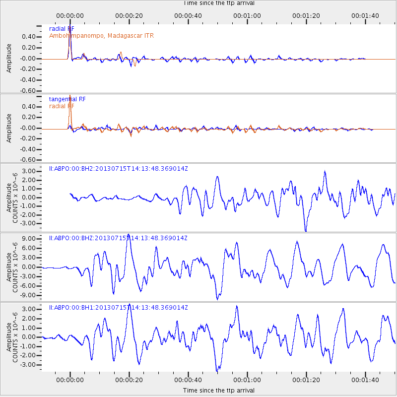
Earthquake location: South Sandwich Islands Region
Earthquake latitude/longitude: -60.9/-25.1
Earthquake time(UTC): 2013/07/15 (196) 14:03:39 GMT
Earthquake Depth: 11 km
Earthquake Magnitude: 7.3 MW, 6.5 MB, 7.1 MS, 7.3 MW
Earthquake Catalog/Contributor: NEIC PDE/NEIC PDE-W
Network: II Global Seismograph Network (GSN - IRIS/IDA)
Station: ABPO Ambohimpanompo, Madagascar
Lat/Lon: 19.02 S/47.23 E
Elevation: 1528 m
Distance: 65.0 deg
Az: 84.154 deg
Baz: 210.977 deg
Ray Param: 0.058584068
Estimated Moho Depth: 44.0 km
Estimated Crust Vp/Vs: 1.62
Assumed Crust Vp: 6.642 km/s
Estimated Crust Vs: 4.113 km/s
Estimated Crust Poisson's Ratio: 0.19
Radial Match: 95.57506 %
Radial Bump: 359
Transverse Match: 87.368706 %
Transverse Bump: 400
SOD ConfigId: 512894
Insert Time: 2013-09-15 19:30:03.204 +0000
GWidth: 2.5
Max Bumps: 400
Tol: 0.001

Signal To Noise

ChannelStoNSTALTA
II:ABPO:00:BHZ:20130715T14:13:48.369014Z3.94202691.0225888E-62.5940685E-7
II:ABPO:00:BH1:20130715T14:13:48.369014Z2.22671413.7753037E-71.6954596E-7
II:ABPO:00:BH2:20130715T14:13:48.369014Z1.9562153.6394357E-71.8604476E-7
Arrivals
Ps4.3 SECOND
PpPs16 SECOND
PsPs/PpSs21 SECOND