You are here: Home > Network List > UW - Pacific Northwest Regional Seismic Network Stations List
> Station STOR Enumclaw, WA, USA > Earthquake Result Viewer
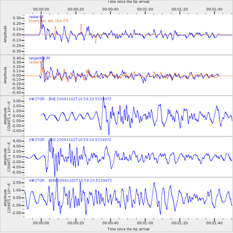
STOR Enumclaw, WA, USA - Earthquake Result Viewer
*The percent match for this event was below the threshold and hence no stack was calculated.
| Earthquake location: |
South Of Tonga Islands |
| Earthquake latitude/longitude: |
-24.1/-175.2 |
| Earthquake time(UTC): |
2009/11/02 (306) 10:47:13 GMT |
| Earthquake Depth: |
9.0 km |
| Earthquake Magnitude: |
6.1 MB, 6.1 MS, 6.2 MW, 6.1 MW |
| Earthquake Catalog/Contributor: |
WHDF/NEIC |
|
| Network: |
UW Pacific Northwest Regional Seismic Network |
| Station: |
STOR Enumclaw, WA, USA |
| Lat/Lon: |
47.19 N/121.99 W |
| Elevation: |
266 m |
|
| Distance: |
85.6 deg |
| Az: |
33.204 deg |
| Baz: |
227.19 deg |
| Ray Param: |
$rayparam |
*The percent match for this event was below the threshold and hence was not used in the summary stack. |
|
| Radial Match: |
81.82273 % |
| Radial Bump: |
400 |
| Transverse Match: |
71.81183 % |
| Transverse Bump: |
400 |
| SOD ConfigId: |
2622 |
| Insert Time: |
2010-02-27 05:03:49.728 +0000 |
| GWidth: |
2.5 |
| Max Bumps: |
400 |
| Tol: |
0.001 |
|
Signal To Noise
| Channel | StoN | STA | LTA |
| UW:STOR: :BHZ:20091102T10:59:20.523997Z | 9.626226 | 2.77087E-6 | 2.878459E-7 |
| UW:STOR: :BHN:20091102T10:59:20.523997Z | 1.2230495 | 6.527106E-7 | 5.336747E-7 |
| UW:STOR: :BHE:20091102T10:59:20.523997Z | 2.3305278 | 1.1417546E-6 | 4.8991245E-7 |
| Arrivals |
| Ps | |
| PpPs | |
| PsPs/PpSs | |


