You are here: Home > Network List > TA - USArray Transportable Network (new EarthScope stations) Stations List
> Station V61A Roper, NC, USA > Earthquake Result Viewer
V61A Roper, NC, USA - Earthquake Result Viewer
*The percent match for this event was below the threshold and hence no stack was calculated.
| Earthquake location: |
Iceland |
| Earthquake latitude/longitude: |
64.6/-17.3 |
| Earthquake time(UTC): |
2014/08/24 (236) 20:39:13 GMT |
| Earthquake Depth: |
13 km |
| Earthquake Magnitude: |
5.3 MW, 5.3 mb, 4.9 MS |
| Earthquake Catalog/Contributor: |
ISC/ISC |
|
| Network: |
TA USArray Transportable Network (new EarthScope stations) |
| Station: |
V61A Roper, NC, USA |
| Lat/Lon: |
35.79 N/76.58 W |
| Elevation: |
4.0 m |
|
| Distance: |
45.2 deg |
| Az: |
260.025 deg |
| Baz: |
31.511 deg |
| Ray Param: |
$rayparam |
*The percent match for this event was below the threshold and hence was not used in the summary stack. |
|
| Radial Match: |
62.944527 % |
| Radial Bump: |
400 |
| Transverse Match: |
46.367855 % |
| Transverse Bump: |
400 |
| SOD ConfigId: |
3390531 |
| Insert Time: |
2019-04-13 14:26:37.613 +0000 |
| GWidth: |
2.5 |
| Max Bumps: |
400 |
| Tol: |
0.001 |
|
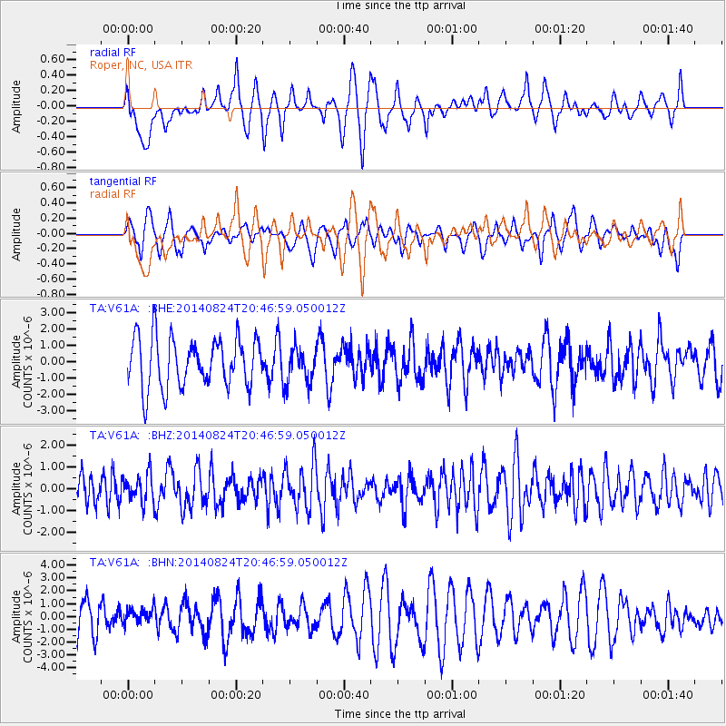
Signal To Noise
| Channel | StoN | STA | LTA |
| TA:V61A: :BHZ:20140824T20:46:59.050012Z | 0.9106438 | 6.4410824E-7 | 7.0731085E-7 |
| TA:V61A: :BHN:20140824T20:46:59.050012Z | 0.448244 | 6.679871E-7 | 1.4902308E-6 |
| TA:V61A: :BHE:20140824T20:46:59.050012Z | 0.7178487 | 1.0983634E-6 | 1.5300766E-6 |
| Arrivals |
| Ps | |
| PpPs | |
| PsPs/PpSs | |


