You are here: Home > Network List > TA - USArray Transportable Network (new EarthScope stations) Stations List
> Station V60A Jim Taylor Road, Stokes, NC, USA > Earthquake Result Viewer
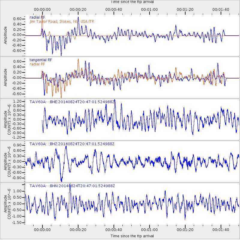
V60A Jim Taylor Road, Stokes, NC, USA - Earthquake Result Viewer
*The percent match for this event was below the threshold and hence no stack was calculated.
| Earthquake location: |
Iceland |
| Earthquake latitude/longitude: |
64.6/-17.3 |
| Earthquake time(UTC): |
2014/08/24 (236) 20:39:13 GMT |
| Earthquake Depth: |
13 km |
| Earthquake Magnitude: |
5.3 MW, 5.3 mb, 4.9 MS |
| Earthquake Catalog/Contributor: |
ISC/ISC |
|
| Network: |
TA USArray Transportable Network (new EarthScope stations) |
| Station: |
V60A Jim Taylor Road, Stokes, NC, USA |
| Lat/Lon: |
35.76 N/77.26 W |
| Elevation: |
8.0 m |
|
| Distance: |
45.5 deg |
| Az: |
260.673 deg |
| Baz: |
31.567 deg |
| Ray Param: |
$rayparam |
*The percent match for this event was below the threshold and hence was not used in the summary stack. |
|
| Radial Match: |
55.808994 % |
| Radial Bump: |
400 |
| Transverse Match: |
48.330044 % |
| Transverse Bump: |
400 |
| SOD ConfigId: |
3390531 |
| Insert Time: |
2019-04-13 14:26:37.657 +0000 |
| GWidth: |
2.5 |
| Max Bumps: |
400 |
| Tol: |
0.001 |
|
Signal To Noise
| Channel | StoN | STA | LTA |
| TA:V60A: :BHZ:20140824T20:47:01.524988Z | 1.2971765 | 2.2507206E-7 | 1.735092E-7 |
| TA:V60A: :BHN:20140824T20:47:01.524988Z | 1.6684728 | 5.535733E-7 | 3.3178443E-7 |
| TA:V60A: :BHE:20140824T20:47:01.524988Z | 1.0026462 | 3.195377E-7 | 3.1869436E-7 |
| Arrivals |
| Ps | |
| PpPs | |
| PsPs/PpSs | |


