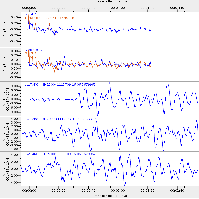
TAKO Tahkenitch, OR CREST BB SMO - Earthquake Result Viewer

Earthquake location: Near West Coast Of Colombia
Earthquake latitude/longitude: 4.7/-77.5
Earthquake time(UTC): 2004/11/15 (320) 09:06:56 GMT
Earthquake Depth: 15 km
Earthquake Magnitude: 6.6 MB, 7.1 MS, 7.2 MW, 7.1 MW
Earthquake Catalog/Contributor: WHDF/NEIC
Network: UW Pacific Northwest Regional Seismic Network
Station: TAKO Tahkenitch, OR CREST BB SMO
Lat/Lon: 43.74 N/124.08 W
Elevation: 46 m
Distance: 56.5 deg
Az: 320.836 deg
Baz: 119.715 deg
Ray Param: 0.06411858
Estimated Moho Depth: 28.25 km
Estimated Crust Vp/Vs: 1.93
Assumed Crust Vp: 6.048 km/s
Estimated Crust Vs: 3.134 km/s
Estimated Crust Poisson's Ratio: 0.32
Radial Match: 87.572395 %
Radial Bump: 400
Transverse Match: 81.551346 %
Transverse Bump: 400
SOD ConfigId: 2459
Insert Time: 2010-02-27 05:04:57.721 +0000
GWidth: 2.5
Max Bumps: 400
Tol: 0.001

Signal To Noise

ChannelStoNSTALTA
UW:TAKO: :BHN:20041115T09:16:06.567996Z1.4216179533.9125375.5668
UW:TAKO: :BHE:20041115T09:16:06.567996Z1.6973563796.4984469.25824
UW:TAKO: :BHZ:20041115T09:16:06.567996Z4.2727562031.9083475.54984
Arrivals
Ps4.5 SECOND
PpPs13 SECOND
PsPs/PpSs18 SECOND