
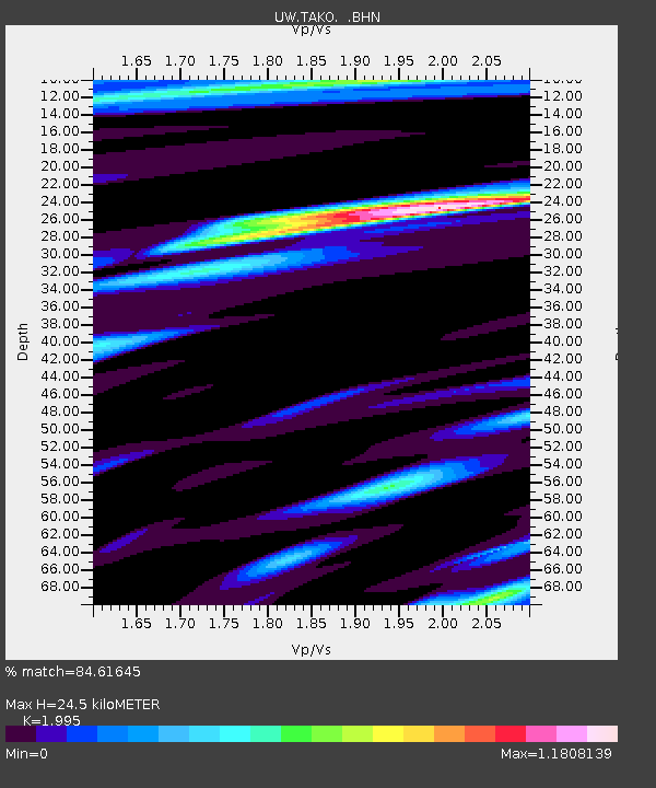
TAKO Tahkenitch, OR CREST BB SMO - Earthquake Result Viewer
| ||||||||||||||||||
| ||||||||||||||||||
| ||||||||||||||||||
|
Signal To Noise
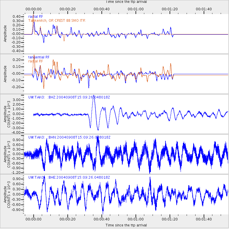
| Channel | StoN | STA | LTA |
| UW:TAKO: :BHN:20040908T15:09:26.048018Z | 1.4211676 | 223.86497 | 157.52188 |
| UW:TAKO: :BHE:20040908T15:09:26.048018Z | 2.3213038 | 326.909 | 140.8299 |
| UW:TAKO: :BHZ:20040908T15:09:26.048018Z | 10.242267 | 1151.2239 | 112.39933 |
| Arrivals | |
| Ps | 4.1 SECOND |
| PpPs | 12 SECOND |
| PsPs/PpSs | 16 SECOND |

