You are here: Home > Network List > UW - Pacific Northwest Regional Seismic Network Stations List
> Station TAKO Tahkenitch, OR CREST BB SMO > Earthquake Result Viewer
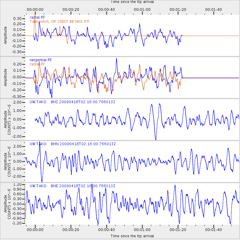
TAKO Tahkenitch, OR CREST BB SMO - Earthquake Result Viewer
*The percent match for this event was below the threshold and hence no stack was calculated.
| Earthquake location: |
Kermadec Islands Region |
| Earthquake latitude/longitude: |
-28.9/-177.4 |
| Earthquake time(UTC): |
2009/04/18 (108) 02:03:52 GMT |
| Earthquake Depth: |
65 km |
| Earthquake Magnitude: |
6.0 MB, 5.8 MW, 5.7 MW |
| Earthquake Catalog/Contributor: |
WHDF/NEIC |
|
| Network: |
UW Pacific Northwest Regional Seismic Network |
| Station: |
TAKO Tahkenitch, OR CREST BB SMO |
| Lat/Lon: |
43.74 N/124.08 W |
| Elevation: |
46 m |
|
| Distance: |
87.3 deg |
| Az: |
35.608 deg |
| Baz: |
224.773 deg |
| Ray Param: |
$rayparam |
*The percent match for this event was below the threshold and hence was not used in the summary stack. |
|
| Radial Match: |
67.90765 % |
| Radial Bump: |
400 |
| Transverse Match: |
62.408268 % |
| Transverse Bump: |
400 |
| SOD ConfigId: |
2658 |
| Insert Time: |
2010-02-27 05:05:17.010 +0000 |
| GWidth: |
2.5 |
| Max Bumps: |
400 |
| Tol: |
0.001 |
|
Signal To Noise
| Channel | StoN | STA | LTA |
| UW:TAKO: :BHN:20090418T02:16:00.766013Z | 2.5348291 | 1.315775E-6 | 5.1907836E-7 |
| UW:TAKO: :BHE:20090418T02:16:00.766013Z | 0.6559397 | 2.9190167E-7 | 4.4501294E-7 |
| UW:TAKO: :BHZ:20090418T02:16:00.766013Z | 1.2565501 | 5.7822206E-7 | 4.6016638E-7 |
| Arrivals |
| Ps | |
| PpPs | |
| PsPs/PpSs | |


