You are here: Home > Network List > TA - USArray Transportable Network (new EarthScope stations) Stations List
> Station M47A Cromwell, IN, USA > Earthquake Result Viewer
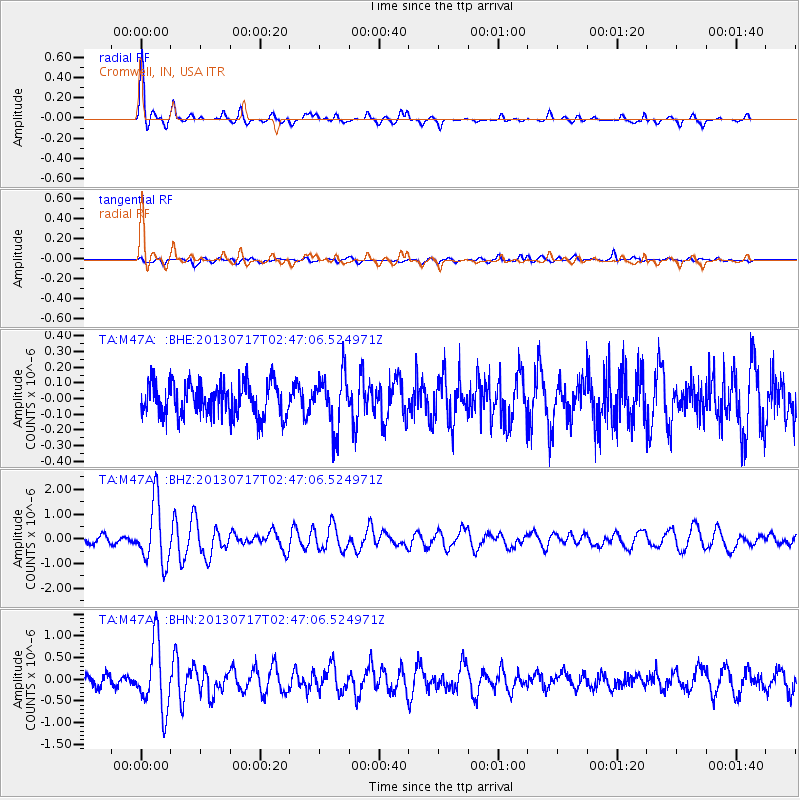
M47A Cromwell, IN, USA - Earthquake Result Viewer
*The percent match for this event was below the threshold and hence no stack was calculated.
| Earthquake location: |
Southern Peru |
| Earthquake latitude/longitude: |
-15.7/-71.7 |
| Earthquake time(UTC): |
2013/07/17 (198) 02:37:43 GMT |
| Earthquake Depth: |
7.0 km |
| Earthquake Magnitude: |
6.0 MW, 5.6 MB, 5.8 MS, 5.8 MW |
| Earthquake Catalog/Contributor: |
NEIC PDE/NEIC PDE-W |
|
| Network: |
TA USArray Transportable Network (new EarthScope stations) |
| Station: |
M47A Cromwell, IN, USA |
| Lat/Lon: |
41.36 N/85.62 W |
| Elevation: |
283 m |
|
| Distance: |
58.2 deg |
| Az: |
347.727 deg |
| Baz: |
164.214 deg |
| Ray Param: |
$rayparam |
*The percent match for this event was below the threshold and hence was not used in the summary stack. |
|
| Radial Match: |
79.85762 % |
| Radial Bump: |
368 |
| Transverse Match: |
68.71415 % |
| Transverse Bump: |
400 |
| SOD ConfigId: |
512894 |
| Insert Time: |
2013-09-15 20:36:18.581 +0000 |
| GWidth: |
2.5 |
| Max Bumps: |
400 |
| Tol: |
0.001 |
|
Signal To Noise
| Channel | StoN | STA | LTA |
| TA:M47A: :BHZ:20130717T02:47:06.524971Z | 10.522996 | 1.2300555E-6 | 1.1689215E-7 |
| TA:M47A: :BHN:20130717T02:47:06.524971Z | 5.749329 | 7.637507E-7 | 1.3284169E-7 |
| TA:M47A: :BHE:20130717T02:47:06.524971Z | 1.626901 | 1.7286996E-7 | 1.06257204E-7 |
| Arrivals |
| Ps | |
| PpPs | |
| PsPs/PpSs | |


