You are here: Home > Network List > TA - USArray Transportable Network (new EarthScope stations) Stations List
> Station O61A Allentown, NJ, USA > Earthquake Result Viewer
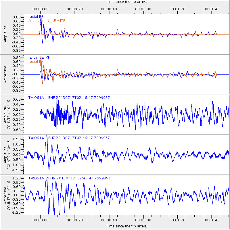
O61A Allentown, NJ, USA - Earthquake Result Viewer
*The percent match for this event was below the threshold and hence no stack was calculated.
| Earthquake location: |
Southern Peru |
| Earthquake latitude/longitude: |
-15.7/-71.7 |
| Earthquake time(UTC): |
2013/07/17 (198) 02:37:43 GMT |
| Earthquake Depth: |
7.0 km |
| Earthquake Magnitude: |
6.0 MW, 5.6 MB, 5.8 MS, 5.8 MW |
| Earthquake Catalog/Contributor: |
NEIC PDE/NEIC PDE-W |
|
| Network: |
TA USArray Transportable Network (new EarthScope stations) |
| Station: |
O61A Allentown, NJ, USA |
| Lat/Lon: |
40.09 N/74.55 W |
| Elevation: |
38 m |
|
| Distance: |
55.5 deg |
| Az: |
357.382 deg |
| Baz: |
176.712 deg |
| Ray Param: |
$rayparam |
*The percent match for this event was below the threshold and hence was not used in the summary stack. |
|
| Radial Match: |
76.241714 % |
| Radial Bump: |
400 |
| Transverse Match: |
59.957256 % |
| Transverse Bump: |
400 |
| SOD ConfigId: |
512894 |
| Insert Time: |
2013-09-15 20:38:41.460 +0000 |
| GWidth: |
2.5 |
| Max Bumps: |
400 |
| Tol: |
0.001 |
|
Signal To Noise
| Channel | StoN | STA | LTA |
| TA:O61A: :BHZ:20130717T02:46:47.799995Z | 3.8387556 | 8.340948E-7 | 2.172826E-7 |
| TA:O61A: :BHN:20130717T02:46:47.799995Z | 1.9690075 | 6.050884E-7 | 3.0730632E-7 |
| TA:O61A: :BHE:20130717T02:46:47.799995Z | 0.60725063 | 1.2327712E-7 | 2.0300864E-7 |
| Arrivals |
| Ps | |
| PpPs | |
| PsPs/PpSs | |


