You are here: Home > Network List > TA - USArray Transportable Network (new EarthScope stations) Stations List
> Station Q53A Leroy, WV, USA > Earthquake Result Viewer
Q53A Leroy, WV, USA - Earthquake Result Viewer

| Earthquake location: |
Southern Peru |
| Earthquake latitude/longitude: |
-15.7/-71.7 |
| Earthquake time(UTC): |
2013/07/17 (198) 02:37:43 GMT |
| Earthquake Depth: |
7.0 km |
| Earthquake Magnitude: |
6.0 MW, 5.6 MB, 5.8 MS, 5.8 MW |
| Earthquake Catalog/Contributor: |
NEIC PDE/NEIC PDE-W |
|
| Network: |
TA USArray Transportable Network (new EarthScope stations) |
| Station: |
Q53A Leroy, WV, USA |
| Lat/Lon: |
38.86 N/81.53 W |
| Elevation: |
310 m |
|
| Distance: |
55.0 deg |
| Az: |
350.677 deg |
| Baz: |
168.47 deg |
| Ray Param: |
0.065093435 |
| Estimated Moho Depth: |
27.75 km |
| Estimated Crust Vp/Vs: |
1.67 |
| Assumed Crust Vp: |
6.207 km/s |
| Estimated Crust Vs: |
3.717 km/s |
| Estimated Crust Poisson's Ratio: |
0.22 |
|
| Radial Match: |
82.49023 % |
| Radial Bump: |
400 |
| Transverse Match: |
77.38217 % |
| Transverse Bump: |
400 |
| SOD ConfigId: |
512894 |
| Insert Time: |
2013-09-15 20:39:41.735 +0000 |
| GWidth: |
2.5 |
| Max Bumps: |
400 |
| Tol: |
0.001 |
|
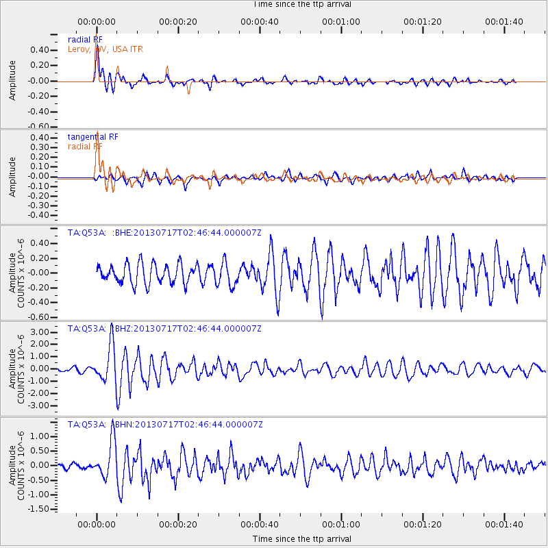
Signal To Noise
| Channel | StoN | STA | LTA |
| TA:Q53A: :BHZ:20130717T02:46:44.000007Z | 9.036114 | 1.5483819E-6 | 1.7135484E-7 |
| TA:Q53A: :BHN:20130717T02:46:44.000007Z | 4.910856 | 6.5608555E-7 | 1.3359903E-7 |
| TA:Q53A: :BHE:20130717T02:46:44.000007Z | 1.2534703 | 1.6200079E-7 | 1.2924183E-7 |
| Arrivals |
| Ps | 3.2 SECOND |
| PpPs | 11 SECOND |
| PsPs/PpSs | 14 SECOND |


