You are here: Home > Network List > IU - Global Seismograph Network (GSN - IRIS/USGS) Stations List
> Station JOHN Johnston Island, USA > Earthquake Result Viewer
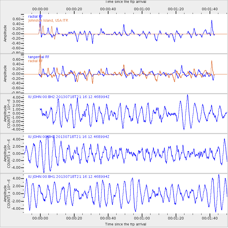
JOHN Johnston Island, USA - Earthquake Result Viewer
*The percent match for this event was below the threshold and hence no stack was calculated.
| Earthquake location: |
Cook Strait, New Zealand |
| Earthquake latitude/longitude: |
-41.5/174.4 |
| Earthquake time(UTC): |
2013/07/18 (199) 21:06:39 GMT |
| Earthquake Depth: |
18 km |
| Earthquake Magnitude: |
5.5 MW, 5.5 MW, 5.7 MB |
| Earthquake Catalog/Contributor: |
NEIC PDE/NEIC PDE-W |
|
| Network: |
IU Global Seismograph Network (GSN - IRIS/USGS) |
| Station: |
JOHN Johnston Island, USA |
| Lat/Lon: |
16.73 N/169.53 W |
| Elevation: |
2.0 m |
|
| Distance: |
59.9 deg |
| Az: |
17.852 deg |
| Baz: |
193.895 deg |
| Ray Param: |
$rayparam |
*The percent match for this event was below the threshold and hence was not used in the summary stack. |
|
| Radial Match: |
68.17109 % |
| Radial Bump: |
400 |
| Transverse Match: |
53.242943 % |
| Transverse Bump: |
400 |
| SOD ConfigId: |
512894 |
| Insert Time: |
2013-09-15 21:03:29.183 +0000 |
| GWidth: |
2.5 |
| Max Bumps: |
400 |
| Tol: |
0.001 |
|
Signal To Noise
| Channel | StoN | STA | LTA |
| IU:JOHN:00:BHZ:20130718T21:16:12.468994Z | 3.030192 | 3.5389585E-6 | 1.1678991E-6 |
| IU:JOHN:00:BH1:20130718T21:16:12.468994Z | 0.8668788 | 1.4983891E-6 | 1.7284874E-6 |
| IU:JOHN:00:BH2:20130718T21:16:12.468994Z | 1.0768493 | 1.8494821E-6 | 1.7174938E-6 |
| Arrivals |
| Ps | |
| PpPs | |
| PsPs/PpSs | |


