TREE Summer Lake, OR, USA - Earthquake Result Viewer
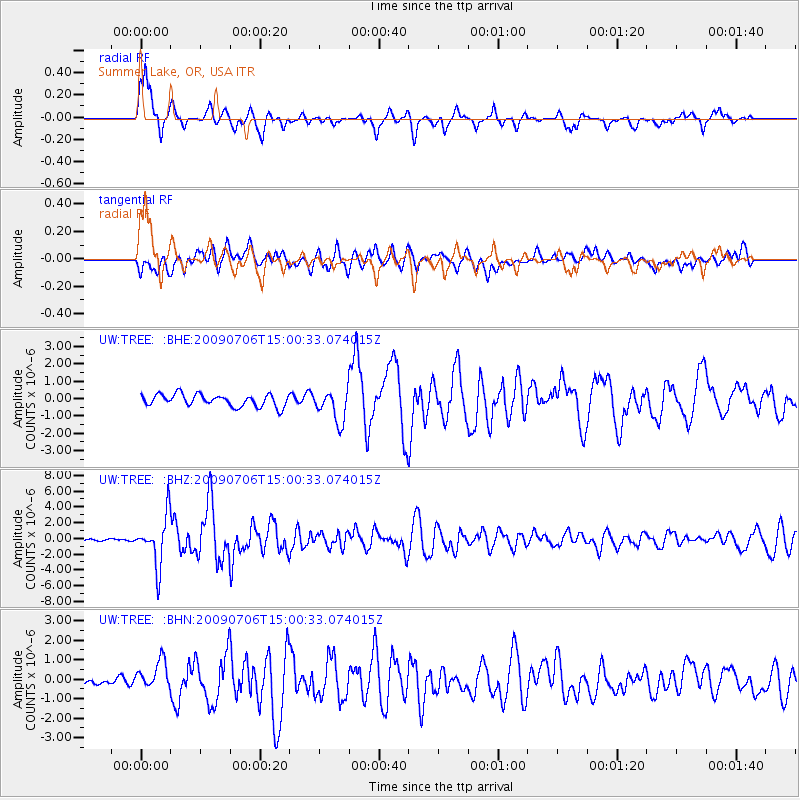
Earthquake location: Rat Islands, Aleutian Islands
Earthquake latitude/longitude: 50.4/177.0
Earthquake time(UTC): 2009/07/06 (187) 14:53:12 GMT
Earthquake Depth: 22 km
Earthquake Magnitude: 6.0 MB, 5.8 MS, 6.1 MW, 6.0 MW
Earthquake Catalog/Contributor: WHDF/NEIC
Network: UW Pacific Northwest Regional Seismic Network
Station: TREE Summer Lake, OR, USA
Lat/Lon: 42.73 N/120.89 W
Elevation: 1887 m
Distance: 42.3 deg
Az: 75.589 deg
Baz: 302.803 deg
Ray Param: 0.073248096
Estimated Moho Depth: 14.75 km
Estimated Crust Vp/Vs: 1.72
Assumed Crust Vp: 6.597 km/s
Estimated Crust Vs: 3.836 km/s
Estimated Crust Poisson's Ratio: 0.24
Radial Match: 86.44789 %
Radial Bump: 344
Transverse Match: 76.56854 %
Transverse Bump: 400
SOD ConfigId: 2648
Insert Time: 2010-02-27 05:06:35.529 +0000
GWidth: 2.5
Max Bumps: 400
Tol: 0.001

Signal To Noise

ChannelStoNSTALTA
UW:TREE: :BHZ:20090706T15:00:33.074015Z20.6406963.1253478E-61.5141678E-7
UW:TREE: :BHN:20090706T15:00:33.074015Z2.71370247.208226E-72.656233E-7
UW:TREE: :BHE:20090706T15:00:33.074015Z2.63560499.1382367E-73.4672254E-7
Arrivals
Ps1.7 SECOND
PpPs5.6 SECOND
PsPs/PpSs7.4 SECOND