You are here: Home > Network List > X812 - Deep Structure of Three Continental Sutures in Eastern North America Stations List
> Station QM20 Hay Lake, Maine, USA > Earthquake Result Viewer
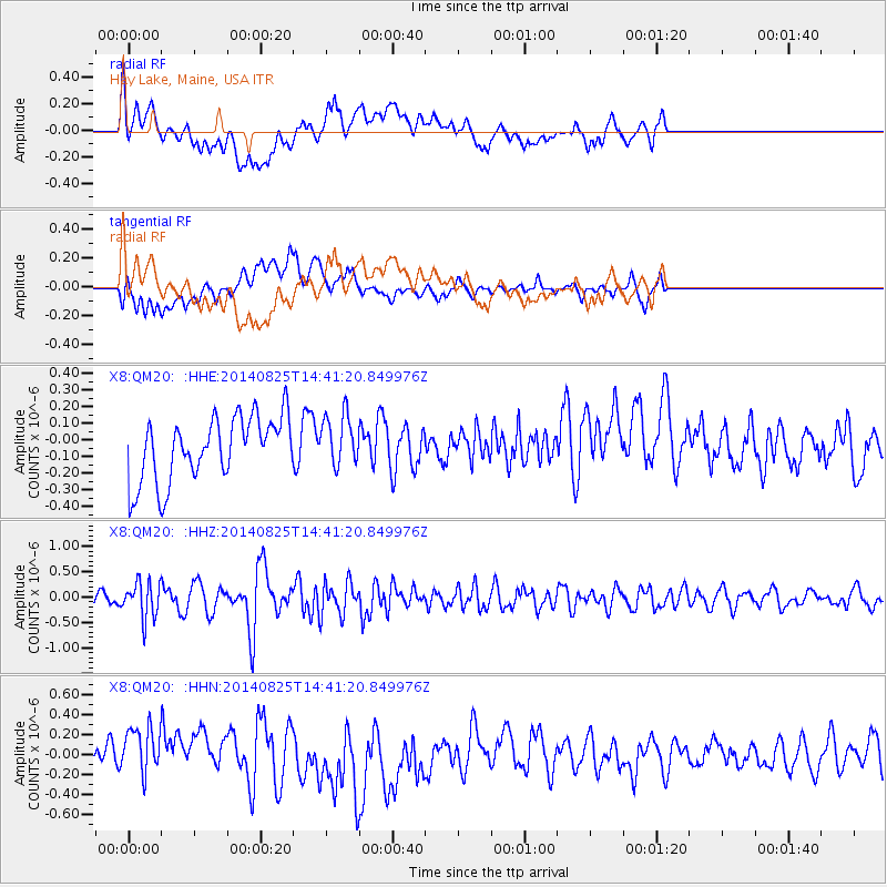
QM20 Hay Lake, Maine, USA - Earthquake Result Viewer
*The percent match for this event was below the threshold and hence no stack was calculated.
| Earthquake location: |
Near Coast Of Peru |
| Earthquake latitude/longitude: |
-16.2/-73.2 |
| Earthquake time(UTC): |
2014/08/25 (237) 14:31:37 GMT |
| Earthquake Depth: |
58 km |
| Earthquake Magnitude: |
5.6 M |
| Earthquake Catalog/Contributor: |
NEIC PDE/NEIC ALERT |
|
| Network: |
X8 Deep Structure of Three Continental Sutures in Eastern North America |
| Station: |
QM20 Hay Lake, Maine, USA |
| Lat/Lon: |
46.13 N/68.72 W |
| Elevation: |
207 m |
|
| Distance: |
62.2 deg |
| Az: |
3.556 deg |
| Baz: |
184.915 deg |
| Ray Param: |
$rayparam |
*The percent match for this event was below the threshold and hence was not used in the summary stack. |
|
| Radial Match: |
61.022488 % |
| Radial Bump: |
400 |
| Transverse Match: |
47.35598 % |
| Transverse Bump: |
400 |
| SOD ConfigId: |
3390531 |
| Insert Time: |
2019-04-13 14:50:13.498 +0000 |
| GWidth: |
2.5 |
| Max Bumps: |
400 |
| Tol: |
0.001 |
|
Signal To Noise
| Channel | StoN | STA | LTA |
| X8:QM20: :HHZ:20140825T14:41:20.849976Z | 2.7177985 | 3.5066185E-7 | 1.2902423E-7 |
| X8:QM20: :HHN:20140825T14:41:20.849976Z | 1.2771794 | 2.4598106E-7 | 1.9259711E-7 |
| X8:QM20: :HHE:20140825T14:41:20.849976Z | 0.8399812 | 1.5167777E-7 | 1.8057283E-7 |
| Arrivals |
| Ps | |
| PpPs | |
| PsPs/PpSs | |


