You are here: Home > Network List > TA - USArray Transportable Network (new EarthScope stations) Stations List
> Station J05D Fort Rock, OR, USA > Earthquake Result Viewer
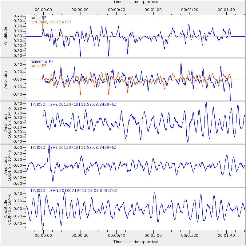
J05D Fort Rock, OR, USA - Earthquake Result Viewer
*The percent match for this event was below the threshold and hence no stack was calculated.
| Earthquake location: |
Kermadec Islands Region |
| Earthquake latitude/longitude: |
-30.5/-176.3 |
| Earthquake time(UTC): |
2013/07/19 (200) 11:40:42 GMT |
| Earthquake Depth: |
22 km |
| Earthquake Magnitude: |
5.7 MW, 5.5 MB, 5.7 MW |
| Earthquake Catalog/Contributor: |
NEIC PDE/NEIC PDE-W |
|
| Network: |
TA USArray Transportable Network (new EarthScope stations) |
| Station: |
J05D Fort Rock, OR, USA |
| Lat/Lon: |
43.28 N/121.23 W |
| Elevation: |
1541 m |
|
| Distance: |
89.1 deg |
| Az: |
36.773 deg |
| Baz: |
225.052 deg |
| Ray Param: |
$rayparam |
*The percent match for this event was below the threshold and hence was not used in the summary stack. |
|
| Radial Match: |
57.82763 % |
| Radial Bump: |
400 |
| Transverse Match: |
50.099583 % |
| Transverse Bump: |
400 |
| SOD ConfigId: |
512894 |
| Insert Time: |
2013-09-15 21:38:10.634 +0000 |
| GWidth: |
2.5 |
| Max Bumps: |
400 |
| Tol: |
0.001 |
|
Signal To Noise
| Channel | StoN | STA | LTA |
| TA:J05D: :BHZ:20130719T11:53:03.849976Z | 2.708674 | 2.597294E-7 | 9.588802E-8 |
| TA:J05D: :BHN:20130719T11:53:03.849976Z | 1.8548843 | 2.7437406E-7 | 1.4791978E-7 |
| TA:J05D: :BHE:20130719T11:53:03.849976Z | 0.44979256 | 5.179917E-8 | 1.1516235E-7 |
| Arrivals |
| Ps | |
| PpPs | |
| PsPs/PpSs | |


