You are here: Home > Network List > US - United States National Seismic Network Stations List
> Station BOZ Bozeman, Montana, USA > Earthquake Result Viewer
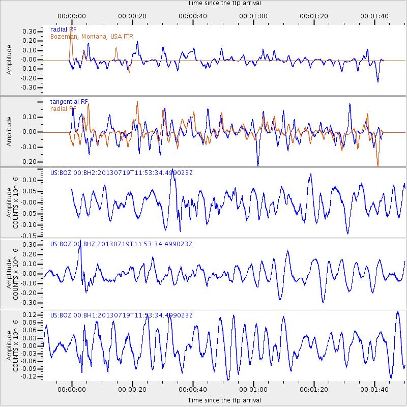
BOZ Bozeman, Montana, USA - Earthquake Result Viewer
*The percent match for this event was below the threshold and hence no stack was calculated.
| Earthquake location: |
Kermadec Islands Region |
| Earthquake latitude/longitude: |
-30.5/-176.3 |
| Earthquake time(UTC): |
2013/07/19 (200) 11:40:42 GMT |
| Earthquake Depth: |
22 km |
| Earthquake Magnitude: |
5.7 MW, 5.5 MB, 5.7 MW |
| Earthquake Catalog/Contributor: |
NEIC PDE/NEIC PDE-W |
|
| Network: |
US United States National Seismic Network |
| Station: |
BOZ Bozeman, Montana, USA |
| Lat/Lon: |
45.65 N/111.63 W |
| Elevation: |
1589 m |
|
| Distance: |
95.8 deg |
| Az: |
39.582 deg |
| Baz: |
231.649 deg |
| Ray Param: |
$rayparam |
*The percent match for this event was below the threshold and hence was not used in the summary stack. |
|
| Radial Match: |
62.06173 % |
| Radial Bump: |
400 |
| Transverse Match: |
52.63945 % |
| Transverse Bump: |
400 |
| SOD ConfigId: |
512894 |
| Insert Time: |
2013-09-15 21:39:23.397 +0000 |
| GWidth: |
2.5 |
| Max Bumps: |
400 |
| Tol: |
0.001 |
|
Signal To Noise
| Channel | StoN | STA | LTA |
| US:BOZ:00:BHZ:20130719T11:53:34.499023Z | 2.754988 | 1.3760628E-7 | 4.994805E-8 |
| US:BOZ:00:BH1:20130719T11:53:34.499023Z | 0.90875095 | 4.3558185E-8 | 4.7931927E-8 |
| US:BOZ:00:BH2:20130719T11:53:34.499023Z | 2.3914769 | 8.844928E-8 | 3.6985217E-8 |
| Arrivals |
| Ps | |
| PpPs | |
| PsPs/PpSs | |


