You are here: Home > Network List > US - United States National Seismic Network Stations List
> Station HAWA Hanford, Washington, USA > Earthquake Result Viewer
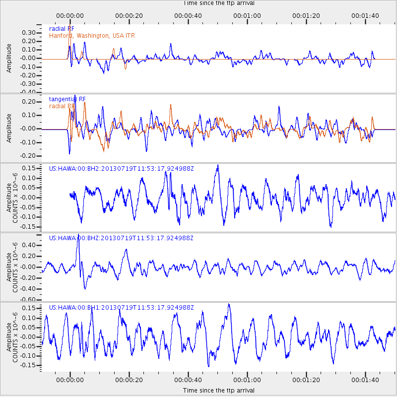
HAWA Hanford, Washington, USA - Earthquake Result Viewer
*The percent match for this event was below the threshold and hence no stack was calculated.
| Earthquake location: |
Kermadec Islands Region |
| Earthquake latitude/longitude: |
-30.5/-176.3 |
| Earthquake time(UTC): |
2013/07/19 (200) 11:40:42 GMT |
| Earthquake Depth: |
22 km |
| Earthquake Magnitude: |
5.7 MW, 5.5 MB, 5.7 MW |
| Earthquake Catalog/Contributor: |
NEIC PDE/NEIC PDE-W |
|
| Network: |
US United States National Seismic Network |
| Station: |
HAWA Hanford, Washington, USA |
| Lat/Lon: |
46.39 N/119.53 W |
| Elevation: |
364 m |
|
| Distance: |
92.1 deg |
| Az: |
35.397 deg |
| Baz: |
226.263 deg |
| Ray Param: |
$rayparam |
*The percent match for this event was below the threshold and hence was not used in the summary stack. |
|
| Radial Match: |
67.539696 % |
| Radial Bump: |
400 |
| Transverse Match: |
63.40716 % |
| Transverse Bump: |
400 |
| SOD ConfigId: |
512894 |
| Insert Time: |
2013-09-15 21:39:31.110 +0000 |
| GWidth: |
2.5 |
| Max Bumps: |
400 |
| Tol: |
0.001 |
|
Signal To Noise
| Channel | StoN | STA | LTA |
| US:HAWA:00:BHZ:20130719T11:53:17.924988Z | 2.9038067 | 2.2529005E-7 | 7.758438E-8 |
| US:HAWA:00:BH1:20130719T11:53:17.924988Z | 1.3265783 | 6.247305E-8 | 4.7093376E-8 |
| US:HAWA:00:BH2:20130719T11:53:17.924988Z | 1.403983 | 6.908453E-8 | 4.92061E-8 |
| Arrivals |
| Ps | |
| PpPs | |
| PsPs/PpSs | |


