You are here: Home > Network List > CN - Canadian National Seismograph Network Stations List
> Station INK INUVIK, NT > Earthquake Result Viewer
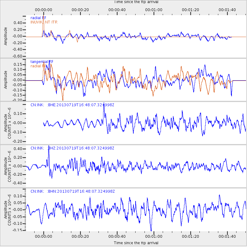
INK INUVIK, NT - Earthquake Result Viewer
*The percent match for this event was below the threshold and hence no stack was calculated.
| Earthquake location: |
Near East Coast Of Honshu, Japan |
| Earthquake latitude/longitude: |
37.5/141.6 |
| Earthquake time(UTC): |
2013/07/19 (200) 16:39:18 GMT |
| Earthquake Depth: |
40 km |
| Earthquake Magnitude: |
5.5 MW |
| Earthquake Catalog/Contributor: |
NEIC PDE/NEIC PDE-W |
|
| Network: |
CN Canadian National Seismograph Network |
| Station: |
INK INUVIK, NT |
| Lat/Lon: |
68.31 N/133.53 W |
| Elevation: |
44 m |
|
| Distance: |
53.9 deg |
| Az: |
27.279 deg |
| Baz: |
281.357 deg |
| Ray Param: |
$rayparam |
*The percent match for this event was below the threshold and hence was not used in the summary stack. |
|
| Radial Match: |
56.736126 % |
| Radial Bump: |
400 |
| Transverse Match: |
53.33972 % |
| Transverse Bump: |
400 |
| SOD ConfigId: |
512894 |
| Insert Time: |
2013-09-15 21:50:37.413 +0000 |
| GWidth: |
2.5 |
| Max Bumps: |
400 |
| Tol: |
0.001 |
|
Signal To Noise
| Channel | StoN | STA | LTA |
| CN:INK: :BHZ:20130719T16:48:07.324998Z | 4.2606997 | 1.626904E-7 | 3.8183963E-8 |
| CN:INK: :BHN:20130719T16:48:07.324998Z | 1.4997327 | 4.8322235E-8 | 3.2220566E-8 |
| CN:INK: :BHE:20130719T16:48:07.324998Z | 2.8039665 | 7.392423E-8 | 2.636416E-8 |
| Arrivals |
| Ps | |
| PpPs | |
| PsPs/PpSs | |


