You are here: Home > Network List > TA - USArray Transportable Network (new EarthScope stations) Stations List
> Station N59A State Game Land 141, Hazleton, PA, USA > Earthquake Result Viewer
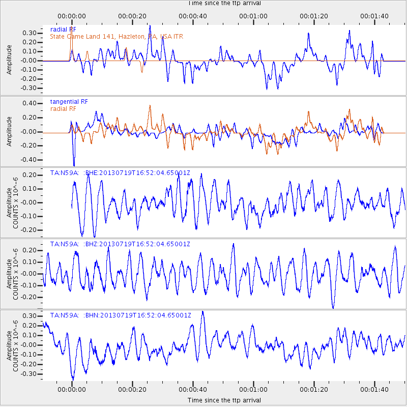
N59A State Game Land 141, Hazleton, PA, USA - Earthquake Result Viewer
*The percent match for this event was below the threshold and hence no stack was calculated.
| Earthquake location: |
Near East Coast Of Honshu, Japan |
| Earthquake latitude/longitude: |
37.5/141.6 |
| Earthquake time(UTC): |
2013/07/19 (200) 16:39:18 GMT |
| Earthquake Depth: |
40 km |
| Earthquake Magnitude: |
5.5 MW |
| Earthquake Catalog/Contributor: |
NEIC PDE/NEIC PDE-W |
|
| Network: |
TA USArray Transportable Network (new EarthScope stations) |
| Station: |
N59A State Game Land 141, Hazleton, PA, USA |
| Lat/Lon: |
40.92 N/75.77 W |
| Elevation: |
508 m |
|
| Distance: |
94.8 deg |
| Az: |
27.506 deg |
| Baz: |
331.008 deg |
| Ray Param: |
$rayparam |
*The percent match for this event was below the threshold and hence was not used in the summary stack. |
|
| Radial Match: |
36.2163 % |
| Radial Bump: |
400 |
| Transverse Match: |
48.322144 % |
| Transverse Bump: |
400 |
| SOD ConfigId: |
512894 |
| Insert Time: |
2013-09-15 22:10:56.506 +0000 |
| GWidth: |
2.5 |
| Max Bumps: |
400 |
| Tol: |
0.001 |
|
Signal To Noise
| Channel | StoN | STA | LTA |
| TA:N59A: :BHZ:20130719T16:52:04.65001Z | 1.0999819 | 1.2078988E-7 | 1.09810784E-7 |
| TA:N59A: :BHN:20130719T16:52:04.65001Z | 2.9851105 | 3.1058363E-7 | 1.0404427E-7 |
| TA:N59A: :BHE:20130719T16:52:04.65001Z | 0.7520831 | 8.036977E-8 | 1.06862885E-7 |
| Arrivals |
| Ps | |
| PpPs | |
| PsPs/PpSs | |


