You are here: Home > Network List > TA - USArray Transportable Network (new EarthScope stations) Stations List
> Station W56A Indian Trail, NC, USA > Earthquake Result Viewer
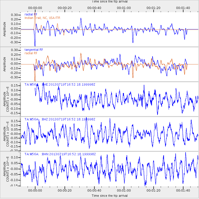
W56A Indian Trail, NC, USA - Earthquake Result Viewer
*The percent match for this event was below the threshold and hence no stack was calculated.
| Earthquake location: |
Near East Coast Of Honshu, Japan |
| Earthquake latitude/longitude: |
37.5/141.6 |
| Earthquake time(UTC): |
2013/07/19 (200) 16:39:18 GMT |
| Earthquake Depth: |
40 km |
| Earthquake Magnitude: |
5.5 MW |
| Earthquake Catalog/Contributor: |
NEIC PDE/NEIC PDE-W |
|
| Network: |
TA USArray Transportable Network (new EarthScope stations) |
| Station: |
W56A Indian Trail, NC, USA |
| Lat/Lon: |
35.13 N/80.58 W |
| Elevation: |
177 m |
|
| Distance: |
97.8 deg |
| Az: |
33.763 deg |
| Baz: |
327.365 deg |
| Ray Param: |
$rayparam |
*The percent match for this event was below the threshold and hence was not used in the summary stack. |
|
| Radial Match: |
45.111923 % |
| Radial Bump: |
400 |
| Transverse Match: |
38.699173 % |
| Transverse Bump: |
400 |
| SOD ConfigId: |
512894 |
| Insert Time: |
2013-09-15 22:14:46.754 +0000 |
| GWidth: |
2.5 |
| Max Bumps: |
400 |
| Tol: |
0.001 |
|
Signal To Noise
| Channel | StoN | STA | LTA |
| TA:W56A: :BHZ:20130719T16:52:18.199998Z | 1.1315042 | 6.916939E-8 | 6.113048E-8 |
| TA:W56A: :BHN:20130719T16:52:18.199998Z | 1.8367453 | 7.485941E-8 | 4.0756554E-8 |
| TA:W56A: :BHE:20130719T16:52:18.199998Z | 1.1654426 | 7.217879E-8 | 6.193252E-8 |
| Arrivals |
| Ps | |
| PpPs | |
| PsPs/PpSs | |


