You are here: Home > Network List > TA - USArray Transportable Network (new EarthScope stations) Stations List
> Station Y49A New Hope, AL, USA > Earthquake Result Viewer
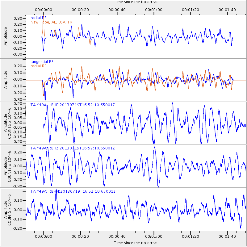
Y49A New Hope, AL, USA - Earthquake Result Viewer
*The percent match for this event was below the threshold and hence no stack was calculated.
| Earthquake location: |
Near East Coast Of Honshu, Japan |
| Earthquake latitude/longitude: |
37.5/141.6 |
| Earthquake time(UTC): |
2013/07/19 (200) 16:39:18 GMT |
| Earthquake Depth: |
40 km |
| Earthquake Magnitude: |
5.5 MW |
| Earthquake Catalog/Contributor: |
NEIC PDE/NEIC PDE-W |
|
| Network: |
TA USArray Transportable Network (new EarthScope stations) |
| Station: |
Y49A New Hope, AL, USA |
| Lat/Lon: |
33.86 N/86.41 W |
| Elevation: |
362 m |
|
| Distance: |
96.1 deg |
| Az: |
38.484 deg |
| Baz: |
323.505 deg |
| Ray Param: |
$rayparam |
*The percent match for this event was below the threshold and hence was not used in the summary stack. |
|
| Radial Match: |
64.153465 % |
| Radial Bump: |
400 |
| Transverse Match: |
66.83294 % |
| Transverse Bump: |
400 |
| SOD ConfigId: |
512894 |
| Insert Time: |
2013-09-15 22:15:14.555 +0000 |
| GWidth: |
2.5 |
| Max Bumps: |
400 |
| Tol: |
0.001 |
|
Signal To Noise
| Channel | StoN | STA | LTA |
| TA:Y49A: :BHZ:20130719T16:52:10.65001Z | 2.3730707 | 1.8687656E-7 | 7.874885E-8 |
| TA:Y49A: :BHN:20130719T16:52:10.65001Z | 0.57793146 | 3.8996873E-8 | 6.7476634E-8 |
| TA:Y49A: :BHE:20130719T16:52:10.65001Z | 0.49574095 | 4.5272436E-8 | 9.1322775E-8 |
| Arrivals |
| Ps | |
| PpPs | |
| PsPs/PpSs | |


