You are here: Home > Network List > CN - Canadian National Seismograph Network Stations List
> Station INK INUVIK, NT > Earthquake Result Viewer
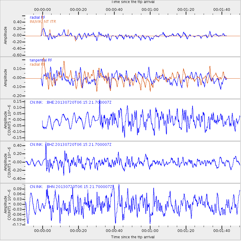
INK INUVIK, NT - Earthquake Result Viewer
*The percent match for this event was below the threshold and hence no stack was calculated.
| Earthquake location: |
Near East Coast Of Honshu, Japan |
| Earthquake latitude/longitude: |
36.3/141.7 |
| Earthquake time(UTC): |
2013/07/20 (201) 06:06:22 GMT |
| Earthquake Depth: |
14 km |
| Earthquake Magnitude: |
5.5 MB |
| Earthquake Catalog/Contributor: |
NEIC PDE/NEIC PDE-W |
|
| Network: |
CN Canadian National Seismograph Network |
| Station: |
INK INUVIK, NT |
| Lat/Lon: |
68.31 N/133.53 W |
| Elevation: |
44 m |
|
| Distance: |
55.0 deg |
| Az: |
26.879 deg |
| Baz: |
280.595 deg |
| Ray Param: |
$rayparam |
*The percent match for this event was below the threshold and hence was not used in the summary stack. |
|
| Radial Match: |
57.84942 % |
| Radial Bump: |
400 |
| Transverse Match: |
45.104263 % |
| Transverse Bump: |
400 |
| SOD ConfigId: |
512894 |
| Insert Time: |
2013-09-15 22:28:18.532 +0000 |
| GWidth: |
2.5 |
| Max Bumps: |
400 |
| Tol: |
0.001 |
|
Signal To Noise
| Channel | StoN | STA | LTA |
| CN:INK: :BHZ:20130720T06:15:21.700007Z | 3.0358942 | 1.366123E-7 | 4.4999034E-8 |
| CN:INK: :BHN:20130720T06:15:21.700007Z | 0.83209276 | 3.5907618E-8 | 4.3153385E-8 |
| CN:INK: :BHE:20130720T06:15:21.700007Z | 1.270144 | 4.743867E-8 | 3.734905E-8 |
| Arrivals |
| Ps | |
| PpPs | |
| PsPs/PpSs | |


