You are here: Home > Network List > IU - Global Seismograph Network (GSN - IRIS/USGS) Stations List
> Station JOHN Johnston Island, USA > Earthquake Result Viewer
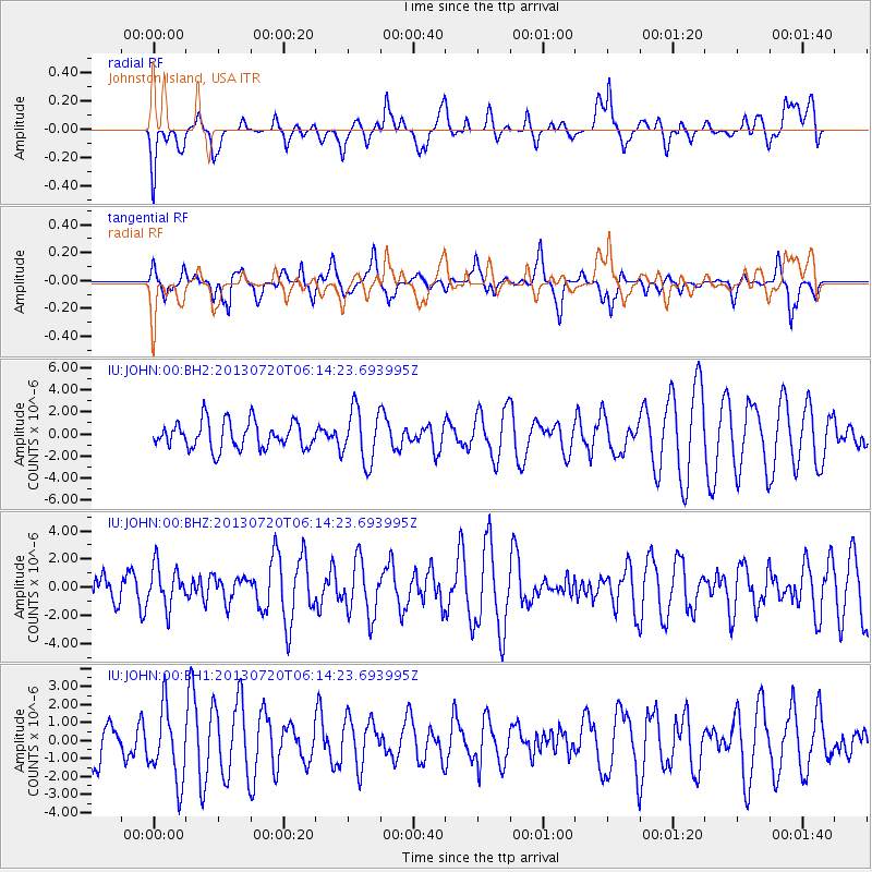
JOHN Johnston Island, USA - Earthquake Result Viewer
*The percent match for this event was below the threshold and hence no stack was calculated.
| Earthquake location: |
Near East Coast Of Honshu, Japan |
| Earthquake latitude/longitude: |
36.3/141.7 |
| Earthquake time(UTC): |
2013/07/20 (201) 06:06:22 GMT |
| Earthquake Depth: |
14 km |
| Earthquake Magnitude: |
5.5 MB |
| Earthquake Catalog/Contributor: |
NEIC PDE/NEIC PDE-W |
|
| Network: |
IU Global Seismograph Network (GSN - IRIS/USGS) |
| Station: |
JOHN Johnston Island, USA |
| Lat/Lon: |
16.73 N/169.53 W |
| Elevation: |
2.0 m |
|
| Distance: |
47.2 deg |
| Az: |
101.031 deg |
| Baz: |
304.105 deg |
| Ray Param: |
$rayparam |
*The percent match for this event was below the threshold and hence was not used in the summary stack. |
|
| Radial Match: |
55.6808 % |
| Radial Bump: |
400 |
| Transverse Match: |
59.703716 % |
| Transverse Bump: |
400 |
| SOD ConfigId: |
512894 |
| Insert Time: |
2013-09-15 22:33:45.807 +0000 |
| GWidth: |
2.5 |
| Max Bumps: |
400 |
| Tol: |
0.001 |
|
Signal To Noise
| Channel | StoN | STA | LTA |
| IU:JOHN:00:BHZ:20130720T06:14:23.693995Z | 0.85800326 | 1.4606823E-6 | 1.7024204E-6 |
| IU:JOHN:00:BH1:20130720T06:14:23.693995Z | 1.362853 | 2.0211107E-6 | 1.4829998E-6 |
| IU:JOHN:00:BH2:20130720T06:14:23.693995Z | 1.9820833 | 2.436205E-6 | 1.2291133E-6 |
| Arrivals |
| Ps | |
| PpPs | |
| PsPs/PpSs | |


