You are here: Home > Network List > TA - USArray Transportable Network (new EarthScope stations) Stations List
> Station E46A Sault Ste Marie, MI, USA > Earthquake Result Viewer
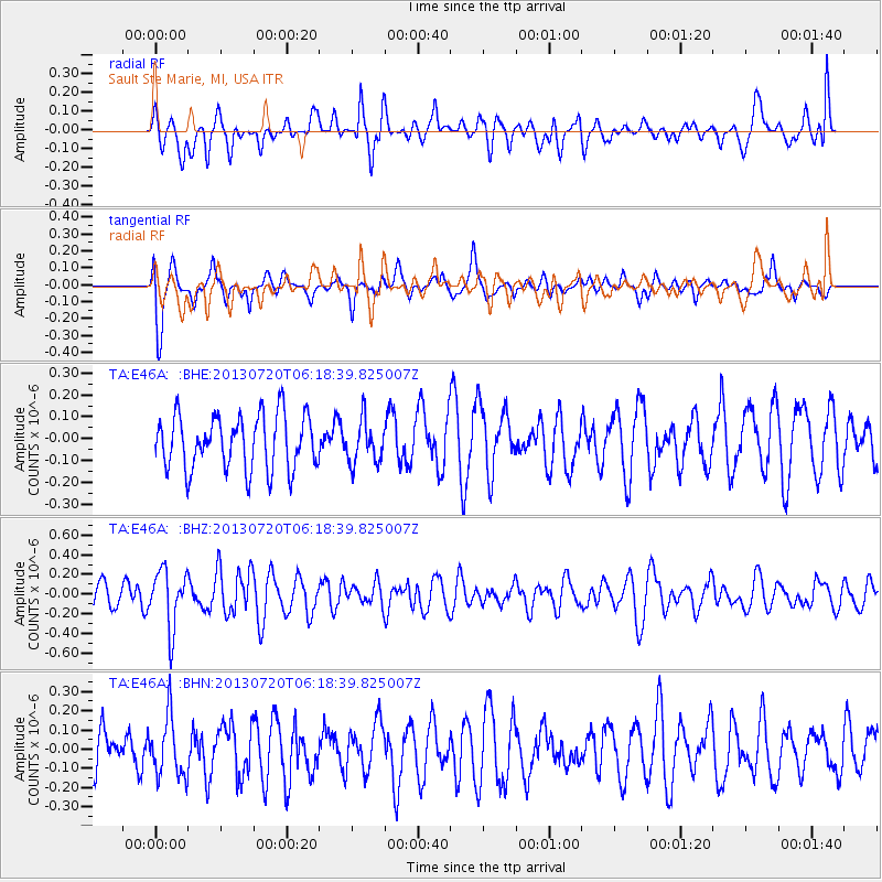
E46A Sault Ste Marie, MI, USA - Earthquake Result Viewer
*The percent match for this event was below the threshold and hence no stack was calculated.
| Earthquake location: |
Near East Coast Of Honshu, Japan |
| Earthquake latitude/longitude: |
36.3/141.7 |
| Earthquake time(UTC): |
2013/07/20 (201) 06:06:22 GMT |
| Earthquake Depth: |
14 km |
| Earthquake Magnitude: |
5.5 MB |
| Earthquake Catalog/Contributor: |
NEIC PDE/NEIC PDE-W |
|
| Network: |
TA USArray Transportable Network (new EarthScope stations) |
| Station: |
E46A Sault Ste Marie, MI, USA |
| Lat/Lon: |
46.37 N/84.31 W |
| Elevation: |
269 m |
|
| Distance: |
87.9 deg |
| Az: |
29.899 deg |
| Baz: |
324.417 deg |
| Ray Param: |
$rayparam |
*The percent match for this event was below the threshold and hence was not used in the summary stack. |
|
| Radial Match: |
60.796597 % |
| Radial Bump: |
400 |
| Transverse Match: |
75.970955 % |
| Transverse Bump: |
400 |
| SOD ConfigId: |
512894 |
| Insert Time: |
2013-09-15 22:43:17.707 +0000 |
| GWidth: |
2.5 |
| Max Bumps: |
400 |
| Tol: |
0.001 |
|
Signal To Noise
| Channel | StoN | STA | LTA |
| TA:E46A: :BHZ:20130720T06:18:39.825007Z | 2.0623312 | 2.946094E-7 | 1.4285261E-7 |
| TA:E46A: :BHN:20130720T06:18:39.825007Z | 0.885721 | 1.5400663E-7 | 1.7387713E-7 |
| TA:E46A: :BHE:20130720T06:18:39.825007Z | 0.772586 | 9.575006E-8 | 1.239345E-7 |
| Arrivals |
| Ps | |
| PpPs | |
| PsPs/PpSs | |


