You are here: Home > Network List > TA - USArray Transportable Network (new EarthScope stations) Stations List
> Station H45A Beulah, MI, USA > Earthquake Result Viewer
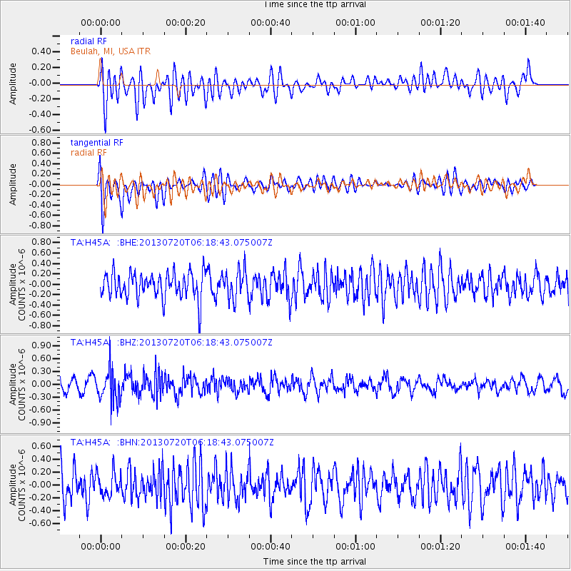
H45A Beulah, MI, USA - Earthquake Result Viewer
*The percent match for this event was below the threshold and hence no stack was calculated.
| Earthquake location: |
Near East Coast Of Honshu, Japan |
| Earthquake latitude/longitude: |
36.3/141.7 |
| Earthquake time(UTC): |
2013/07/20 (201) 06:06:22 GMT |
| Earthquake Depth: |
14 km |
| Earthquake Magnitude: |
5.5 MB |
| Earthquake Catalog/Contributor: |
NEIC PDE/NEIC PDE-W |
|
| Network: |
TA USArray Transportable Network (new EarthScope stations) |
| Station: |
H45A Beulah, MI, USA |
| Lat/Lon: |
44.62 N/86.04 W |
| Elevation: |
242 m |
|
| Distance: |
88.6 deg |
| Az: |
31.916 deg |
| Baz: |
323.242 deg |
| Ray Param: |
$rayparam |
*The percent match for this event was below the threshold and hence was not used in the summary stack. |
|
| Radial Match: |
49.758526 % |
| Radial Bump: |
400 |
| Transverse Match: |
71.69729 % |
| Transverse Bump: |
400 |
| SOD ConfigId: |
512894 |
| Insert Time: |
2013-09-15 22:44:12.564 +0000 |
| GWidth: |
2.5 |
| Max Bumps: |
400 |
| Tol: |
0.001 |
|
Signal To Noise
| Channel | StoN | STA | LTA |
| TA:H45A: :BHZ:20130720T06:18:43.075007Z | 2.020771 | 3.778475E-7 | 1.8698185E-7 |
| TA:H45A: :BHN:20130720T06:18:43.075007Z | 0.7541076 | 1.8600853E-7 | 2.4666048E-7 |
| TA:H45A: :BHE:20130720T06:18:43.075007Z | 1.1349761 | 2.7950767E-7 | 2.4626743E-7 |
| Arrivals |
| Ps | |
| PpPs | |
| PsPs/PpSs | |


