You are here: Home > Network List > TA - USArray Transportable Network (new EarthScope stations) Stations List
> Station O03E Paynes Creek, CA, USA > Earthquake Result Viewer
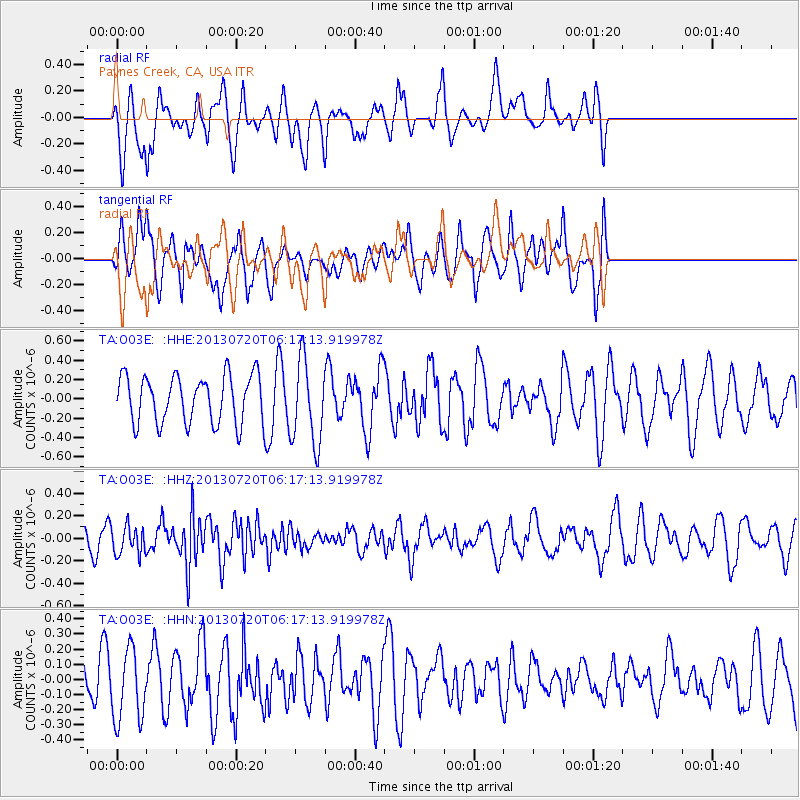
O03E Paynes Creek, CA, USA - Earthquake Result Viewer
*The percent match for this event was below the threshold and hence no stack was calculated.
| Earthquake location: |
Near East Coast Of Honshu, Japan |
| Earthquake latitude/longitude: |
36.3/141.7 |
| Earthquake time(UTC): |
2013/07/20 (201) 06:06:22 GMT |
| Earthquake Depth: |
14 km |
| Earthquake Magnitude: |
5.5 MB |
| Earthquake Catalog/Contributor: |
NEIC PDE/NEIC PDE-W |
|
| Network: |
TA USArray Transportable Network (new EarthScope stations) |
| Station: |
O03E Paynes Creek, CA, USA |
| Lat/Lon: |
40.29 N/121.80 W |
| Elevation: |
967 m |
|
| Distance: |
72.0 deg |
| Az: |
53.047 deg |
| Baz: |
302.378 deg |
| Ray Param: |
$rayparam |
*The percent match for this event was below the threshold and hence was not used in the summary stack. |
|
| Radial Match: |
71.6455 % |
| Radial Bump: |
389 |
| Transverse Match: |
67.44825 % |
| Transverse Bump: |
400 |
| SOD ConfigId: |
512894 |
| Insert Time: |
2013-09-15 22:47:16.165 +0000 |
| GWidth: |
2.5 |
| Max Bumps: |
400 |
| Tol: |
0.001 |
|
Signal To Noise
| Channel | StoN | STA | LTA |
| TA:O03E: :HHZ:20130720T06:17:13.919978Z | 1.4848217 | 1.2456877E-7 | 8.389477E-8 |
| TA:O03E: :HHN:20130720T06:17:13.919978Z | 1.995358 | 2.3926958E-7 | 1.1991311E-7 |
| TA:O03E: :HHE:20130720T06:17:13.919978Z | 1.7999719 | 4.409219E-7 | 2.4496043E-7 |
| Arrivals |
| Ps | |
| PpPs | |
| PsPs/PpSs | |


