You are here: Home > Network List > IU - Global Seismograph Network (GSN - IRIS/USGS) Stations List
> Station POHA Pohakuloa, Hawaii, USA > Earthquake Result Viewer
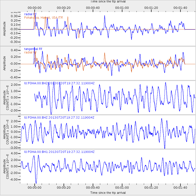
POHA Pohakuloa, Hawaii, USA - Earthquake Result Viewer
*The percent match for this event was below the threshold and hence no stack was calculated.
| Earthquake location: |
Cook Strait, New Zealand |
| Earthquake latitude/longitude: |
-41.6/174.4 |
| Earthquake time(UTC): |
2013/07/20 (201) 19:17:10 GMT |
| Earthquake Depth: |
14 km |
| Earthquake Magnitude: |
5.7 MW, 5.6 MS, 5.8 MB, 5.9 MW |
| Earthquake Catalog/Contributor: |
NEIC PDE/NEIC PDE-W |
|
| Network: |
IU Global Seismograph Network (GSN - IRIS/USGS) |
| Station: |
POHA Pohakuloa, Hawaii, USA |
| Lat/Lon: |
19.76 N/155.53 W |
| Elevation: |
1990 m |
|
| Distance: |
67.1 deg |
| Az: |
30.819 deg |
| Baz: |
204.062 deg |
| Ray Param: |
$rayparam |
*The percent match for this event was below the threshold and hence was not used in the summary stack. |
|
| Radial Match: |
57.229984 % |
| Radial Bump: |
400 |
| Transverse Match: |
46.309647 % |
| Transverse Bump: |
343 |
| SOD ConfigId: |
512894 |
| Insert Time: |
2013-09-15 23:01:43.631 +0000 |
| GWidth: |
2.5 |
| Max Bumps: |
400 |
| Tol: |
0.001 |
|
Signal To Noise
| Channel | StoN | STA | LTA |
| IU:POHA:00:BHZ:20130720T19:27:32.119004Z | 1.1130673 | 1.3203115E-6 | 1.1861921E-6 |
| IU:POHA:00:BH1:20130720T19:27:32.119004Z | 2.530485 | 2.6802927E-6 | 1.0592012E-6 |
| IU:POHA:00:BH2:20130720T19:27:32.119004Z | 0.98213655 | 1.0964005E-6 | 1.1163422E-6 |
| Arrivals |
| Ps | |
| PpPs | |
| PsPs/PpSs | |


