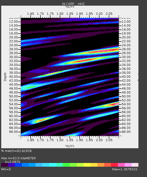
CGRP Cima Grappa - Earthquake Result Viewer
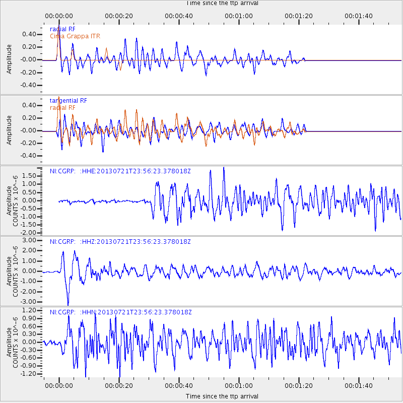
Earthquake location: Gansu, China
Earthquake latitude/longitude: 34.5/104.3
Earthquake time(UTC): 2013/07/21 (202) 23:45:56 GMT
Earthquake Depth: 8.0 km
Earthquake Magnitude: 5.9 MW, 5.9 MW, 6.1 MB, 6.2 MS
Earthquake Catalog/Contributor: NEIC PDE/NEIC PDE-W
Network: NI North-East Italy Broadband Network
Station: CGRP Cima Grappa
Lat/Lon: 45.88 N/11.80 E
Elevation: 1757 m
Distance: 67.7 deg
Az: 311.051 deg
Baz: 63.058 deg
Ray Param: 0.056764632
Estimated Moho Depth: 53.5 km
Estimated Crust Vp/Vs: 2.10
Assumed Crust Vp: 6.155 km/s
Estimated Crust Vs: 2.934 km/s
Estimated Crust Poisson's Ratio: 0.35
Radial Match: 82.61926 %
Radial Bump: 400
Transverse Match: 76.48399 %
Transverse Bump: 400
SOD ConfigId: 512894
Insert Time: 2013-09-15 23:34:04.228 +0000
GWidth: 2.5
Max Bumps: 400
Tol: 0.001

Signal To Noise

ChannelStoNSTALTA
NI:CGRP: :HHZ:20130721T23:56:23.378018Z22.9391771.2844379E-65.59932E-8
NI:CGRP: :HHN:20130721T23:56:23.378018Z7.30248743.786179E-75.18478E-8
NI:CGRP: :HHE:20130721T23:56:23.378018Z11.9760026.2719545E-75.2371018E-8
Arrivals
Ps9.8 SECOND
PpPs26 SECOND
PsPs/PpSs36 SECOND