You are here: Home > Network List > CN - Canadian National Seismograph Network Stations List
> Station INK INUVIK, NT > Earthquake Result Viewer
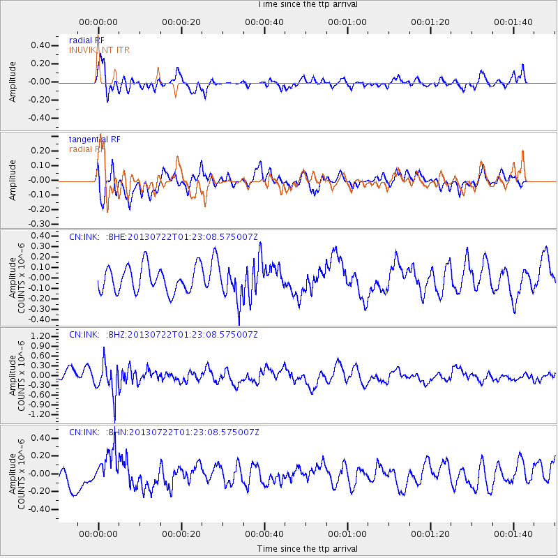
INK INUVIK, NT - Earthquake Result Viewer
*The percent match for this event was below the threshold and hence no stack was calculated.
| Earthquake location: |
Gansu, China |
| Earthquake latitude/longitude: |
34.5/104.2 |
| Earthquake time(UTC): |
2013/07/22 (203) 01:12:34 GMT |
| Earthquake Depth: |
10 km |
| Earthquake Magnitude: |
5.6 MB |
| Earthquake Catalog/Contributor: |
NEIC PDE/NEIC PDE-W |
|
| Network: |
CN Canadian National Seismograph Network |
| Station: |
INK INUVIK, NT |
| Lat/Lon: |
68.31 N/133.53 W |
| Elevation: |
44 m |
|
| Distance: |
68.9 deg |
| Az: |
19.683 deg |
| Baz: |
311.587 deg |
| Ray Param: |
$rayparam |
*The percent match for this event was below the threshold and hence was not used in the summary stack. |
|
| Radial Match: |
72.30585 % |
| Radial Bump: |
400 |
| Transverse Match: |
59.80947 % |
| Transverse Bump: |
400 |
| SOD ConfigId: |
512894 |
| Insert Time: |
2013-09-15 23:51:50.172 +0000 |
| GWidth: |
2.5 |
| Max Bumps: |
400 |
| Tol: |
0.001 |
|
Signal To Noise
| Channel | StoN | STA | LTA |
| CN:INK: :BHZ:20130722T01:23:08.575007Z | 2.4093032 | 4.7411723E-7 | 1.9678603E-7 |
| CN:INK: :BHN:20130722T01:23:08.575007Z | 2.1579456 | 2.1479127E-7 | 9.9535065E-8 |
| CN:INK: :BHE:20130722T01:23:08.575007Z | 1.258713 | 1.5287434E-7 | 1.2145289E-7 |
| Arrivals |
| Ps | |
| PpPs | |
| PsPs/PpSs | |


