You are here: Home > Network List > TA - USArray Transportable Network (new EarthScope stations) Stations List
> Station G59A Clarenceville, QC, USA > Earthquake Result Viewer
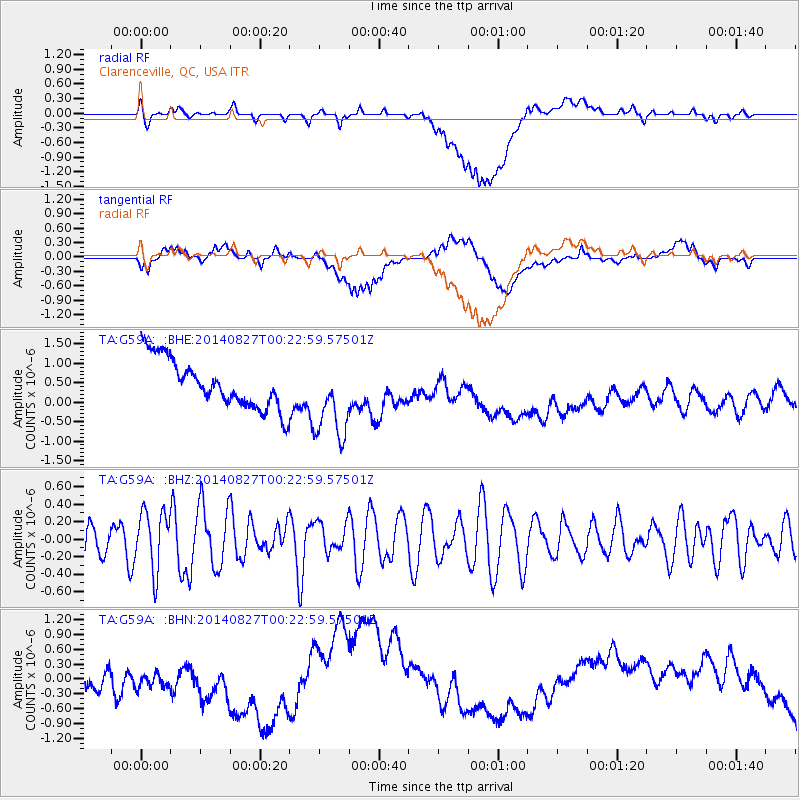
G59A Clarenceville, QC, USA - Earthquake Result Viewer
*The percent match for this event was below the threshold and hence no stack was calculated.
| Earthquake location: |
Iceland |
| Earthquake latitude/longitude: |
64.5/-17.7 |
| Earthquake time(UTC): |
2014/08/27 (239) 00:16:29 GMT |
| Earthquake Depth: |
3.7 km |
| Earthquake Magnitude: |
5.3 Mww, 5.2 mb |
| Earthquake Catalog/Contributor: |
ISC/ISC |
|
| Network: |
TA USArray Transportable Network (new EarthScope stations) |
| Station: |
G59A Clarenceville, QC, USA |
| Lat/Lon: |
45.08 N/73.18 W |
| Elevation: |
36 m |
|
| Distance: |
35.9 deg |
| Az: |
264.405 deg |
| Baz: |
37.396 deg |
| Ray Param: |
$rayparam |
*The percent match for this event was below the threshold and hence was not used in the summary stack. |
|
| Radial Match: |
30.285976 % |
| Radial Bump: |
400 |
| Transverse Match: |
14.452266 % |
| Transverse Bump: |
400 |
| SOD ConfigId: |
3390531 |
| Insert Time: |
2019-04-13 15:22:01.787 +0000 |
| GWidth: |
2.5 |
| Max Bumps: |
400 |
| Tol: |
0.001 |
|
Signal To Noise
| Channel | StoN | STA | LTA |
| TA:G59A: :BHZ:20140827T00:22:59.57501Z | 2.112538 | 3.377142E-7 | 1.5986183E-7 |
| TA:G59A: :BHN:20140827T00:22:59.57501Z | 0.76191133 | 1.719511E-7 | 2.2568386E-7 |
| TA:G59A: :BHE:20140827T00:22:59.57501Z | 1.6704798 | 1.0441038E-6 | 6.2503227E-7 |
| Arrivals |
| Ps | |
| PpPs | |
| PsPs/PpSs | |


