You are here: Home > Network List > II - Global Seismograph Network (GSN - IRIS/IDA) Stations List
> Station WRAB Tennant Creek, NT, Australia > Earthquake Result Viewer
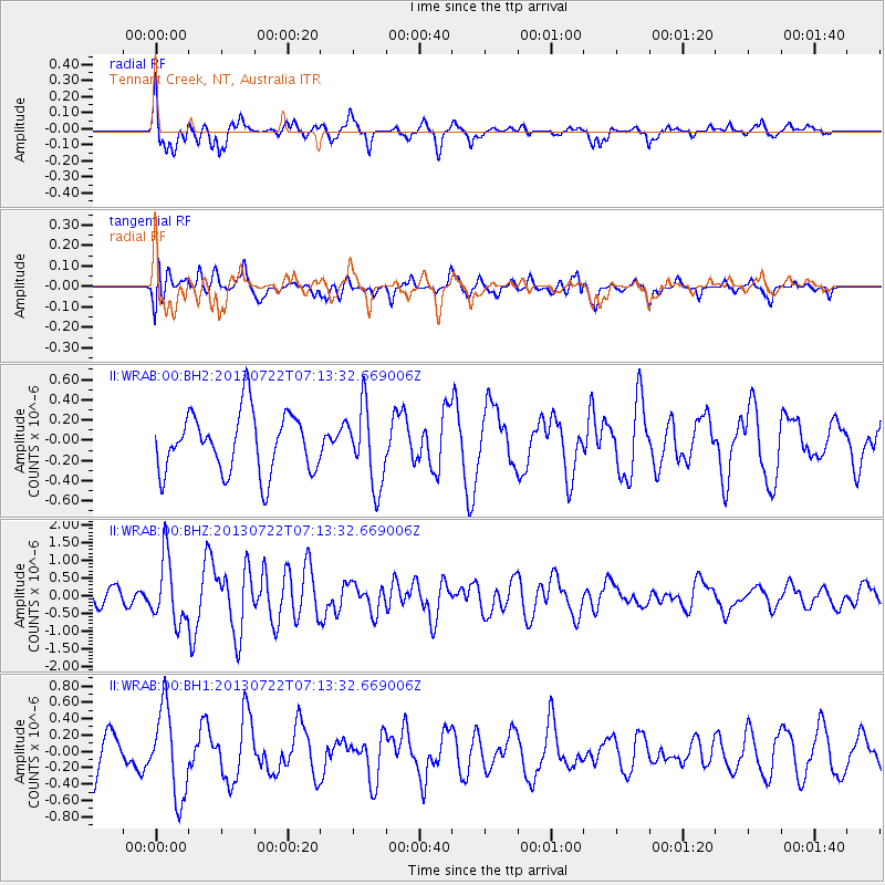
WRAB Tennant Creek, NT, Australia - Earthquake Result Viewer
*The percent match for this event was below the threshold and hence no stack was calculated.
| Earthquake location: |
Prince Edward Islands Region |
| Earthquake latitude/longitude: |
-46.0/34.8 |
| Earthquake time(UTC): |
2013/07/22 (203) 07:01:42 GMT |
| Earthquake Depth: |
10 km |
| Earthquake Magnitude: |
6.3 MW, 5.8 MB, 6.0 MS, 6.1 MW |
| Earthquake Catalog/Contributor: |
NEIC PDE/NEIC PDE-W |
|
| Network: |
II Global Seismograph Network (GSN - IRIS/IDA) |
| Station: |
WRAB Tennant Creek, NT, Australia |
| Lat/Lon: |
19.93 S/134.36 E |
| Elevation: |
366 m |
|
| Distance: |
82.3 deg |
| Az: |
110.584 deg |
| Baz: |
223.869 deg |
| Ray Param: |
$rayparam |
*The percent match for this event was below the threshold and hence was not used in the summary stack. |
|
| Radial Match: |
79.4263 % |
| Radial Bump: |
383 |
| Transverse Match: |
40.782444 % |
| Transverse Bump: |
400 |
| SOD ConfigId: |
512894 |
| Insert Time: |
2013-09-16 00:08:24.782 +0000 |
| GWidth: |
2.5 |
| Max Bumps: |
400 |
| Tol: |
0.001 |
|
Signal To Noise
| Channel | StoN | STA | LTA |
| II:WRAB:00:BHZ:20130722T07:13:32.669006Z | 3.8557415 | 9.0877467E-7 | 2.3569389E-7 |
| II:WRAB:00:BH1:20130722T07:13:32.669006Z | 2.8342843 | 5.366349E-7 | 1.89337E-7 |
| II:WRAB:00:BH2:20130722T07:13:32.669006Z | 1.302941 | 3.854238E-7 | 2.9581062E-7 |
| Arrivals |
| Ps | |
| PpPs | |
| PsPs/PpSs | |


