You are here: Home > Network List > TA - USArray Transportable Network (new EarthScope stations) Stations List
> Station J01E Myrtle Point, OR, USA > Earthquake Result Viewer
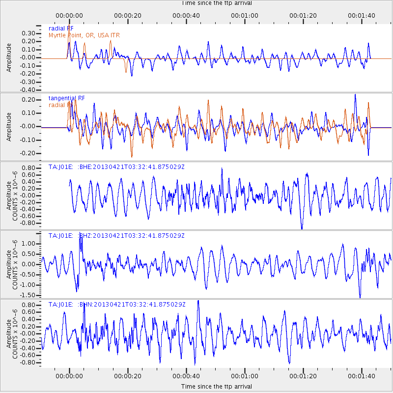
J01E Myrtle Point, OR, USA - Earthquake Result Viewer
*The percent match for this event was below the threshold and hence no stack was calculated.
| Earthquake location: |
Southeast Of Honshu, Japan |
| Earthquake latitude/longitude: |
29.9/138.9 |
| Earthquake time(UTC): |
2013/04/21 (111) 03:22:16 GMT |
| Earthquake Depth: |
422 km |
| Earthquake Magnitude: |
6.1 MW, 5.7 MB, 6.1 MW |
| Earthquake Catalog/Contributor: |
NEIC PDE/NEIC PDE-W |
|
| Network: |
TA USArray Transportable Network (new EarthScope stations) |
| Station: |
J01E Myrtle Point, OR, USA |
| Lat/Lon: |
43.16 N/123.93 W |
| Elevation: |
128 m |
|
| Distance: |
75.0 deg |
| Az: |
48.731 deg |
| Baz: |
296.916 deg |
| Ray Param: |
$rayparam |
*The percent match for this event was below the threshold and hence was not used in the summary stack. |
|
| Radial Match: |
58.77042 % |
| Radial Bump: |
400 |
| Transverse Match: |
47.88354 % |
| Transverse Bump: |
400 |
| SOD ConfigId: |
558458 |
| Insert Time: |
2013-09-16 17:38:53.580 +0000 |
| GWidth: |
2.5 |
| Max Bumps: |
400 |
| Tol: |
0.001 |
|
Signal To Noise
| Channel | StoN | STA | LTA |
| TA:J01E: :BHZ:20130421T03:32:41.875029Z | 2.7296128 | 7.316691E-7 | 2.680487E-7 |
| TA:J01E: :BHN:20130421T03:32:41.875029Z | 1.0520945 | 2.1941402E-7 | 2.0854972E-7 |
| TA:J01E: :BHE:20130421T03:32:41.875029Z | 0.85228646 | 2.4945578E-7 | 2.926901E-7 |
| Arrivals |
| Ps | |
| PpPs | |
| PsPs/PpSs | |


