You are here: Home > Network List > US - United States National Seismic Network Stations List
> Station DGMT Dagmar, Montana, USA > Earthquake Result Viewer
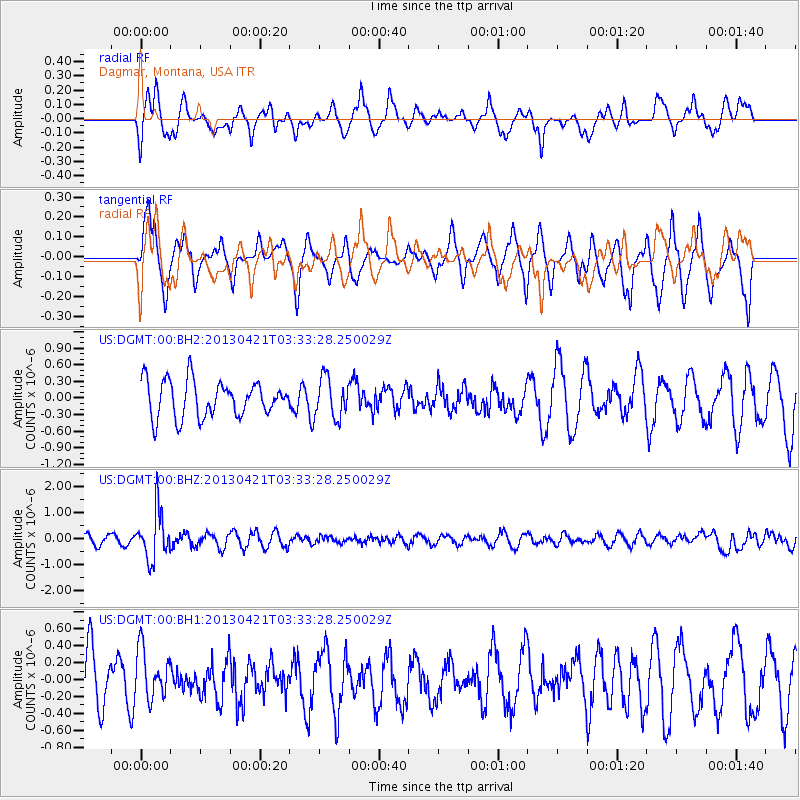
DGMT Dagmar, Montana, USA - Earthquake Result Viewer
*The percent match for this event was below the threshold and hence no stack was calculated.
| Earthquake location: |
Southeast Of Honshu, Japan |
| Earthquake latitude/longitude: |
29.9/138.9 |
| Earthquake time(UTC): |
2013/04/21 (111) 03:22:16 GMT |
| Earthquake Depth: |
422 km |
| Earthquake Magnitude: |
6.1 MW, 5.7 MB, 6.1 MW |
| Earthquake Catalog/Contributor: |
NEIC PDE/NEIC PDE-W |
|
| Network: |
US United States National Seismic Network |
| Station: |
DGMT Dagmar, Montana, USA |
| Lat/Lon: |
48.47 N/104.20 W |
| Elevation: |
0.0 m |
|
| Distance: |
83.7 deg |
| Az: |
36.652 deg |
| Baz: |
308.863 deg |
| Ray Param: |
$rayparam |
*The percent match for this event was below the threshold and hence was not used in the summary stack. |
|
| Radial Match: |
44.000465 % |
| Radial Bump: |
316 |
| Transverse Match: |
49.703594 % |
| Transverse Bump: |
398 |
| SOD ConfigId: |
558458 |
| Insert Time: |
2013-09-16 17:40:59.703 +0000 |
| GWidth: |
2.5 |
| Max Bumps: |
400 |
| Tol: |
0.001 |
|
Signal To Noise
| Channel | StoN | STA | LTA |
| US:DGMT:00:BHZ:20130421T03:33:28.250029Z | 6.1381574 | 9.228276E-7 | 1.5034277E-7 |
| US:DGMT:00:BH1:20130421T03:33:28.250029Z | 0.99642056 | 2.9855389E-7 | 2.9962638E-7 |
| US:DGMT:00:BH2:20130421T03:33:28.250029Z | 1.1154867 | 3.6274534E-7 | 3.251902E-7 |
| Arrivals |
| Ps | |
| PpPs | |
| PsPs/PpSs | |


