You are here: Home > Network List > CI - Caltech Regional Seismic Network Stations List
> Station SLA SLA, Trona, CA, USA > Earthquake Result Viewer
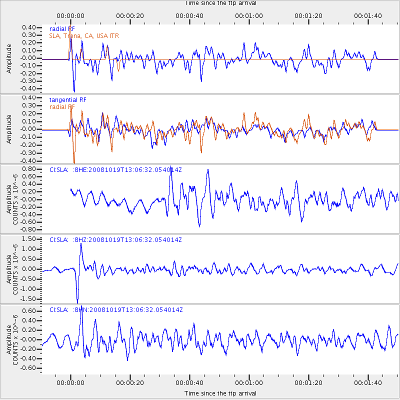
SLA SLA, Trona, CA, USA - Earthquake Result Viewer
*The percent match for this event was below the threshold and hence no stack was calculated.
| Earthquake location: |
Tonga Islands |
| Earthquake latitude/longitude: |
-22.0/-173.7 |
| Earthquake time(UTC): |
2008/10/19 (293) 12:55:05 GMT |
| Earthquake Depth: |
35 km |
| Earthquake Magnitude: |
5.7 MB, 5.3 MS, 5.6 MW, 5.5 MW |
| Earthquake Catalog/Contributor: |
WHDF/NEIC |
|
| Network: |
CI Caltech Regional Seismic Network |
| Station: |
SLA SLA, Trona, CA, USA |
| Lat/Lon: |
35.89 N/117.28 W |
| Elevation: |
1174 m |
|
| Distance: |
78.5 deg |
| Az: |
43.66 deg |
| Baz: |
232.112 deg |
| Ray Param: |
$rayparam |
*The percent match for this event was below the threshold and hence was not used in the summary stack. |
|
| Radial Match: |
54.8898 % |
| Radial Bump: |
400 |
| Transverse Match: |
49.951313 % |
| Transverse Bump: |
400 |
| SOD ConfigId: |
2560 |
| Insert Time: |
2010-02-25 20:36:07.544 +0000 |
| GWidth: |
2.5 |
| Max Bumps: |
400 |
| Tol: |
0.001 |
|
Signal To Noise
| Channel | StoN | STA | LTA |
| CI:SLA: :BHZ:20081019T13:06:32.054014Z | 5.937238 | 6.827683E-7 | 1.1499763E-7 |
| CI:SLA: :BHN:20081019T13:06:32.054014Z | 2.9640455 | 2.685743E-7 | 9.061072E-8 |
| CI:SLA: :BHE:20081019T13:06:32.054014Z | 2.0744123 | 3.2025838E-7 | 1.5438512E-7 |
| Arrivals |
| Ps | |
| PpPs | |
| PsPs/PpSs | |


