You are here: Home > Network List > US - United States National Seismic Network Stations List
> Station CBKS Cedar Bluff, Kansas, USA > Earthquake Result Viewer
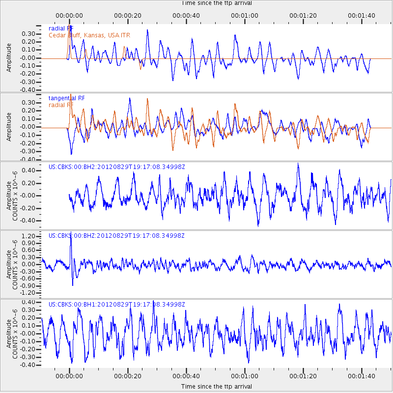
CBKS Cedar Bluff, Kansas, USA - Earthquake Result Viewer
*The percent match for this event was below the threshold and hence no stack was calculated.
| Earthquake location: |
Near East Coast Of Honshu, Japan |
| Earthquake latitude/longitude: |
38.4/141.8 |
| Earthquake time(UTC): |
2012/08/29 (242) 19:05:11 GMT |
| Earthquake Depth: |
47 km |
| Earthquake Magnitude: |
5.8 MB, 5.1 MS, 5.5 MW, 5.5 MW |
| Earthquake Catalog/Contributor: |
WHDF/NEIC |
|
| Network: |
US United States National Seismic Network |
| Station: |
CBKS Cedar Bluff, Kansas, USA |
| Lat/Lon: |
38.81 N/99.74 W |
| Elevation: |
677 m |
|
| Distance: |
84.6 deg |
| Az: |
43.627 deg |
| Baz: |
316.078 deg |
| Ray Param: |
$rayparam |
*The percent match for this event was below the threshold and hence was not used in the summary stack. |
|
| Radial Match: |
64.623505 % |
| Radial Bump: |
400 |
| Transverse Match: |
52.97647 % |
| Transverse Bump: |
397 |
| SOD ConfigId: |
558545 |
| Insert Time: |
2013-09-17 15:23:39.144 +0000 |
| GWidth: |
2.5 |
| Max Bumps: |
400 |
| Tol: |
0.001 |
|
Signal To Noise
| Channel | StoN | STA | LTA |
| US:CBKS:00:BHZ:20120829T19:17:08.34998Z | 3.8738909 | 4.4444087E-7 | 1.1472726E-7 |
| US:CBKS:00:BH1:20120829T19:17:08.34998Z | 1.0411184 | 1.9832206E-7 | 1.9048943E-7 |
| US:CBKS:00:BH2:20120829T19:17:08.34998Z | 1.1632671 | 1.631573E-7 | 1.402578E-7 |
| Arrivals |
| Ps | |
| PpPs | |
| PsPs/PpSs | |


