You are here: Home > Network List > US - United States National Seismic Network Stations List
> Station HAWA Hanford, Washington, USA > Earthquake Result Viewer
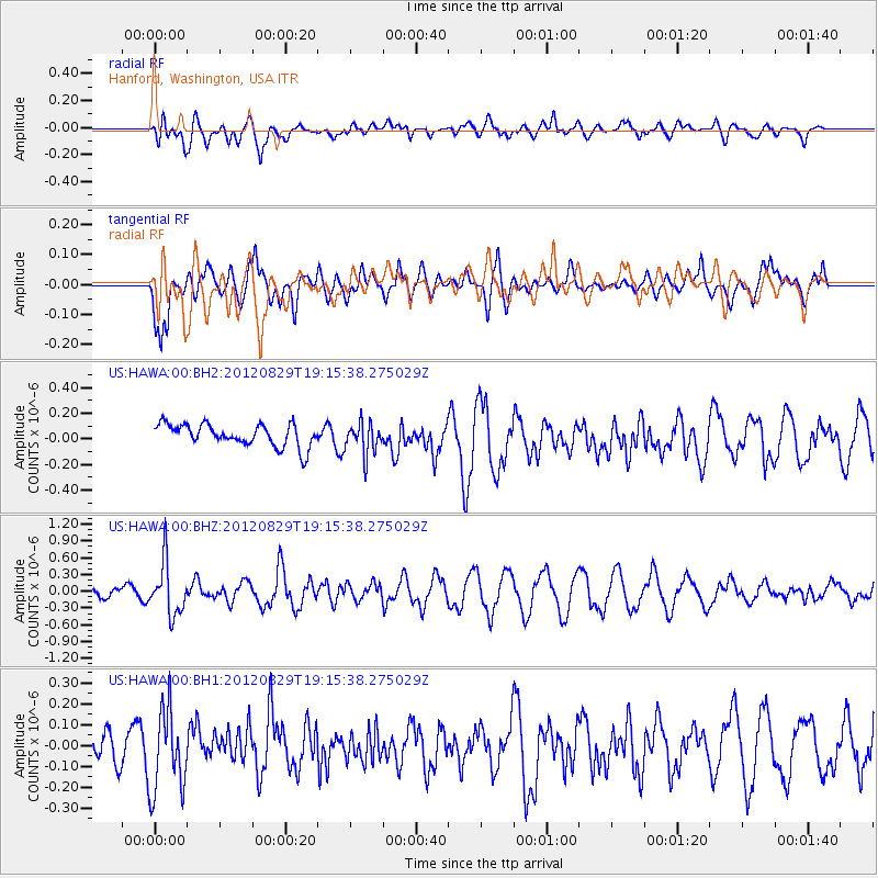
HAWA Hanford, Washington, USA - Earthquake Result Viewer
*The percent match for this event was below the threshold and hence no stack was calculated.
| Earthquake location: |
Near East Coast Of Honshu, Japan |
| Earthquake latitude/longitude: |
38.4/141.8 |
| Earthquake time(UTC): |
2012/08/29 (242) 19:05:11 GMT |
| Earthquake Depth: |
47 km |
| Earthquake Magnitude: |
5.8 MB, 5.1 MS, 5.5 MW, 5.5 MW |
| Earthquake Catalog/Contributor: |
WHDF/NEIC |
|
| Network: |
US United States National Seismic Network |
| Station: |
HAWA Hanford, Washington, USA |
| Lat/Lon: |
46.39 N/119.53 W |
| Elevation: |
364 m |
|
| Distance: |
68.6 deg |
| Az: |
47.303 deg |
| Baz: |
303.486 deg |
| Ray Param: |
$rayparam |
*The percent match for this event was below the threshold and hence was not used in the summary stack. |
|
| Radial Match: |
54.45949 % |
| Radial Bump: |
400 |
| Transverse Match: |
79.48338 % |
| Transverse Bump: |
400 |
| SOD ConfigId: |
558545 |
| Insert Time: |
2013-09-17 15:24:14.918 +0000 |
| GWidth: |
2.5 |
| Max Bumps: |
400 |
| Tol: |
0.001 |
|
Signal To Noise
| Channel | StoN | STA | LTA |
| US:HAWA:00:BHZ:20120829T19:15:38.275029Z | 3.7075098 | 4.6507927E-7 | 1.254425E-7 |
| US:HAWA:00:BH1:20120829T19:15:38.275029Z | 1.7202674 | 1.9723404E-7 | 1.1465313E-7 |
| US:HAWA:00:BH2:20120829T19:15:38.275029Z | 1.4128169 | 1.2209827E-7 | 8.642186E-8 |
| Arrivals |
| Ps | |
| PpPs | |
| PsPs/PpSs | |


