You are here: Home > Network List > US - United States National Seismic Network Stations List
> Station GLMI Grayling, Michigan, USA > Earthquake Result Viewer
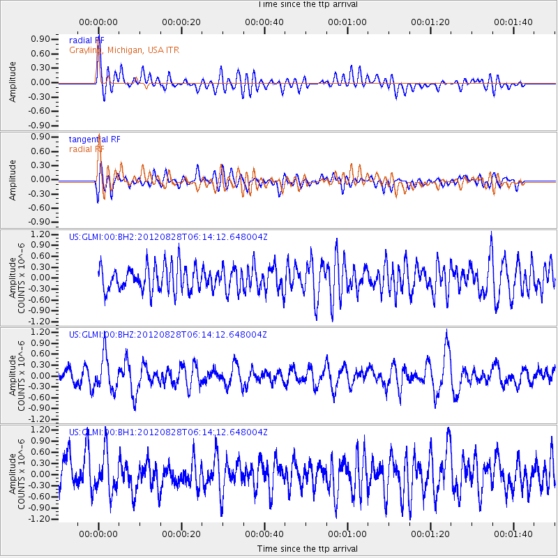
GLMI Grayling, Michigan, USA - Earthquake Result Viewer
*The percent match for this event was below the threshold and hence no stack was calculated.
| Earthquake location: |
Off Coast Of Central America |
| Earthquake latitude/longitude: |
12.5/-88.7 |
| Earthquake time(UTC): |
2012/08/28 (241) 06:08:16 GMT |
| Earthquake Depth: |
35 km |
| Earthquake Magnitude: |
5.5 MW, 5.0 MS, 5.1 MB, 5.5 MW |
| Earthquake Catalog/Contributor: |
WHDF/NEIC |
|
| Network: |
US United States National Seismic Network |
| Station: |
GLMI Grayling, Michigan, USA |
| Lat/Lon: |
44.82 N/84.62 W |
| Elevation: |
387 m |
|
| Distance: |
32.4 deg |
| Az: |
5.359 deg |
| Baz: |
187.364 deg |
| Ray Param: |
$rayparam |
*The percent match for this event was below the threshold and hence was not used in the summary stack. |
|
| Radial Match: |
63.968132 % |
| Radial Bump: |
400 |
| Transverse Match: |
54.285877 % |
| Transverse Bump: |
400 |
| SOD ConfigId: |
558545 |
| Insert Time: |
2013-09-17 15:27:47.208 +0000 |
| GWidth: |
2.5 |
| Max Bumps: |
400 |
| Tol: |
0.001 |
|
Signal To Noise
| Channel | StoN | STA | LTA |
| US:GLMI:00:BHZ:20120828T06:14:12.648004Z | 2.3091893 | 4.775222E-7 | 2.0679211E-7 |
| US:GLMI:00:BH1:20120828T06:14:12.648004Z | 1.4210992 | 5.2784844E-7 | 3.7143676E-7 |
| US:GLMI:00:BH2:20120828T06:14:12.648004Z | 0.89083326 | 3.0970614E-7 | 3.4765893E-7 |
| Arrivals |
| Ps | |
| PpPs | |
| PsPs/PpSs | |


