You are here: Home > Network List > US - United States National Seismic Network Stations List
> Station EGMT Eagleton, Montana, USA > Earthquake Result Viewer
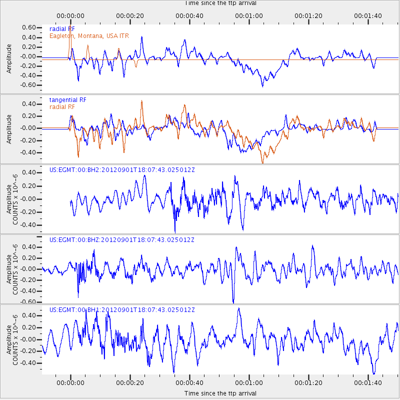
EGMT Eagleton, Montana, USA - Earthquake Result Viewer
*The percent match for this event was below the threshold and hence no stack was calculated.
| Earthquake location: |
Chiapas, Mexico |
| Earthquake latitude/longitude: |
16.2/-92.8 |
| Earthquake time(UTC): |
2012/09/01 (245) 18:01:48 GMT |
| Earthquake Depth: |
257 km |
| Earthquake Magnitude: |
5.5 MW |
| Earthquake Catalog/Contributor: |
NEIC PDE/NEIC PDE-W |
|
| Network: |
US United States National Seismic Network |
| Station: |
EGMT Eagleton, Montana, USA |
| Lat/Lon: |
48.02 N/109.75 W |
| Elevation: |
1055 m |
|
| Distance: |
34.7 deg |
| Az: |
339.828 deg |
| Baz: |
150.431 deg |
| Ray Param: |
$rayparam |
*The percent match for this event was below the threshold and hence was not used in the summary stack. |
|
| Radial Match: |
47.11807 % |
| Radial Bump: |
400 |
| Transverse Match: |
38.33615 % |
| Transverse Bump: |
400 |
| SOD ConfigId: |
558545 |
| Insert Time: |
2013-09-17 15:57:32.109 +0000 |
| GWidth: |
2.5 |
| Max Bumps: |
400 |
| Tol: |
0.001 |
|
Signal To Noise
| Channel | StoN | STA | LTA |
| US:EGMT:00:BHZ:20120901T18:07:43.025012Z | 1.923317 | 1.4263857E-7 | 7.41628E-8 |
| US:EGMT:00:BH1:20120901T18:07:43.025012Z | 1.9382125 | 2.4428925E-7 | 1.2603843E-7 |
| US:EGMT:00:BH2:20120901T18:07:43.025012Z | 0.9828895 | 1.1560507E-7 | 1.1761757E-7 |
| Arrivals |
| Ps | |
| PpPs | |
| PsPs/PpSs | |


