CASY Casey, Antarctica - Earthquake Result Viewer
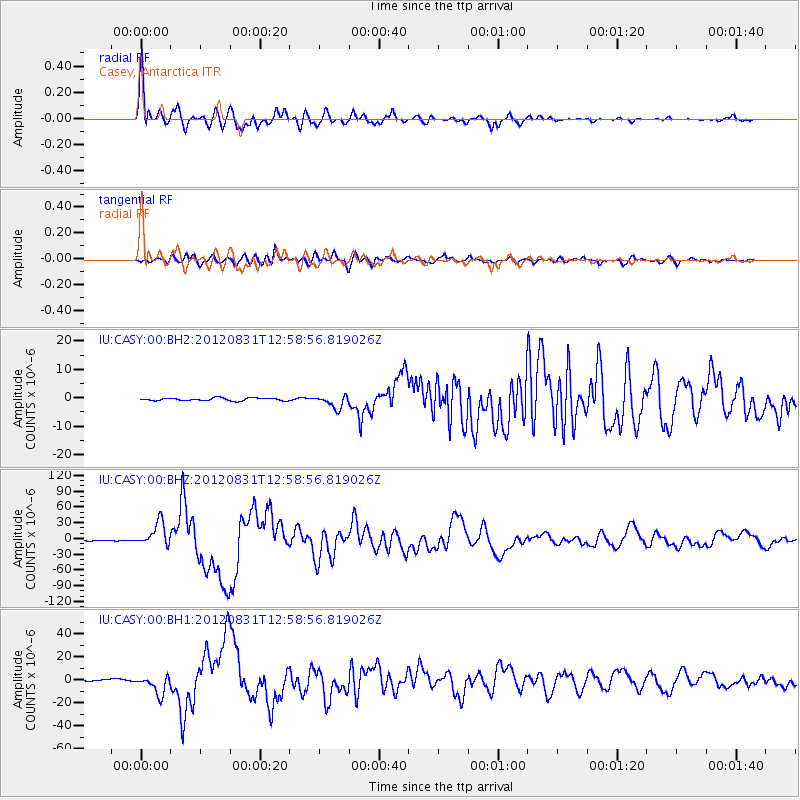
Earthquake location: Philippine Islands Region
Earthquake latitude/longitude: 10.8/126.6
Earthquake time(UTC): 2012/08/31 (244) 12:47:33 GMT
Earthquake Depth: 28 km
Earthquake Magnitude: 7.6 MW, 7.2 MB, 7.6 MS, 7.6 MW
Earthquake Catalog/Contributor: NEIC PDE/NEIC PDE-W
Network: IU Global Seismograph Network (GSN - IRIS/USGS)
Station: CASY Casey, Antarctica
Lat/Lon: 66.28 S/110.54 E
Elevation: 10 m
Distance: 77.8 deg
Az: 186.592 deg
Baz: 16.189 deg
Ray Param: 0.050045054
Estimated Moho Depth: 56.0 km
Estimated Crust Vp/Vs: 1.68
Assumed Crust Vp: 6.356 km/s
Estimated Crust Vs: 3.795 km/s
Estimated Crust Poisson's Ratio: 0.22
Radial Match: 94.235695 %
Radial Bump: 400
Transverse Match: 85.9091 %
Transverse Bump: 400
SOD ConfigId: 558545
Insert Time: 2013-09-17 16:02:23.381 +0000
GWidth: 2.5
Max Bumps: 400
Tol: 0.001

Signal To Noise

ChannelStoNSTALTA
IU:CASY:00:BHZ:20120831T12:58:56.819026Z32.0807232.2770675E-57.09793E-7
IU:CASY:00:BH1:20120831T12:58:56.819026Z14.1617628.399387E-65.9310327E-7
IU:CASY:00:BH2:20120831T12:58:56.819026Z4.7404012.2593074E-64.766068E-7
Arrivals
Ps6.1 SECOND
PpPs23 SECOND
PsPs/PpSs29 SECOND