CTAO Charters Towers, Australia - Earthquake Result Viewer
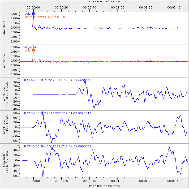
Earthquake location: Philippine Islands Region
Earthquake latitude/longitude: 10.8/126.6
Earthquake time(UTC): 2012/08/31 (244) 12:47:33 GMT
Earthquake Depth: 28 km
Earthquake Magnitude: 7.6 MW, 7.2 MB, 7.6 MS, 7.6 MW
Earthquake Catalog/Contributor: NEIC PDE/NEIC PDE-W
Network: IU Global Seismograph Network (GSN - IRIS/USGS)
Station: CTAO Charters Towers, Australia
Lat/Lon: 20.09 S/146.25 E
Elevation: 357 m
Distance: 36.3 deg
Az: 147.767 deg
Baz: 326.116 deg
Ray Param: 0.076723695
Estimated Moho Depth: 36.25 km
Estimated Crust Vp/Vs: 1.81
Assumed Crust Vp: 6.522 km/s
Estimated Crust Vs: 3.608 km/s
Estimated Crust Poisson's Ratio: 0.28
Radial Match: 95.8889 %
Radial Bump: 223
Transverse Match: 78.875755 %
Transverse Bump: 400
SOD ConfigId: 558545
Insert Time: 2013-09-17 16:02:30.390 +0000
GWidth: 2.5
Max Bumps: 400
Tol: 0.001

Signal To Noise

ChannelStoNSTALTA
IU:CTAO:00:BHZ:20120831T12:54:03.669001Z38.7835122.3075265E-55.9497614E-7
IU:CTAO:00:BH1:20120831T12:54:03.669001Z25.1512241.2827745E-55.100247E-7
IU:CTAO:00:BH2:20120831T12:54:03.669001Z23.338228.402386E-63.6002686E-7
Arrivals
Ps4.8 SECOND
PpPs14 SECOND
PsPs/PpSs19 SECOND