HNR Honiara, Solomon Islands - Earthquake Result Viewer
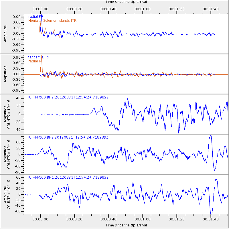
Earthquake location: Philippine Islands Region
Earthquake latitude/longitude: 10.8/126.6
Earthquake time(UTC): 2012/08/31 (244) 12:47:33 GMT
Earthquake Depth: 28 km
Earthquake Magnitude: 7.6 MW, 7.2 MB, 7.6 MS, 7.6 MW
Earthquake Catalog/Contributor: NEIC PDE/NEIC PDE-W
Network: IU Global Seismograph Network (GSN - IRIS/USGS)
Station: HNR Honiara, Solomon Islands
Lat/Lon: 9.44 S/159.95 E
Elevation: 100 m
Distance: 38.8 deg
Az: 120.072 deg
Baz: 300.486 deg
Ray Param: 0.075325295
Estimated Moho Depth: 10.0 km
Estimated Crust Vp/Vs: 1.60
Assumed Crust Vp: 6.183 km/s
Estimated Crust Vs: 3.864 km/s
Estimated Crust Poisson's Ratio: 0.18
Radial Match: 83.804245 %
Radial Bump: 400
Transverse Match: 57.61566 %
Transverse Bump: 400
SOD ConfigId: 558545
Insert Time: 2013-09-17 16:02:43.374 +0000
GWidth: 2.5
Max Bumps: 400
Tol: 0.001

Signal To Noise

ChannelStoNSTALTA
IU:HNR:00:BHZ:20120831T12:54:24.718989Z25.5352541.5996678E-56.264546E-7
IU:HNR:00:BH1:20120831T12:54:24.718989Z17.9597827.4618733E-64.1547685E-7
IU:HNR:00:BH2:20120831T12:54:24.718989Z18.6962039.05549E-64.8434913E-7
Arrivals
Ps1.0 SECOND
PpPs3.9 SECOND
PsPs/PpSs5.0 SECOND