
NWAO Narrogin, Australia - Earthquake Result Viewer
| ||||||||||||||||||
| ||||||||||||||||||
| ||||||||||||||||||
|
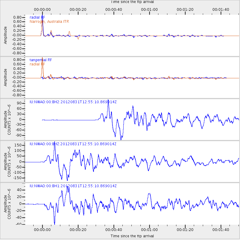
Signal To Noise
| Channel | StoN | STA | LTA |
| IU:NWAO:00:BHZ:20120831T12:55:10.869014Z | 36.612965 | 2.8014567E-5 | 7.6515425E-7 |
| IU:NWAO:00:BH1:20120831T12:55:10.869014Z | 14.867607 | 7.727617E-6 | 5.19762E-7 |
| IU:NWAO:00:BH2:20120831T12:55:10.869014Z | 37.210293 | 1.717657E-5 | 4.6160804E-7 |
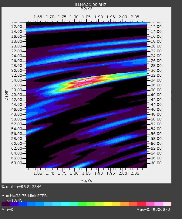
| Arrivals | |
| Ps | 4.7 SECOND |
| PpPs | 14 SECOND |
| PsPs/PpSs | 19 SECOND |

