You are here: Home > Network List > IU - Global Seismograph Network (GSN - IRIS/USGS) Stations List
> Station MAKZ Makanchi, Kazakhstan > Earthquake Result Viewer
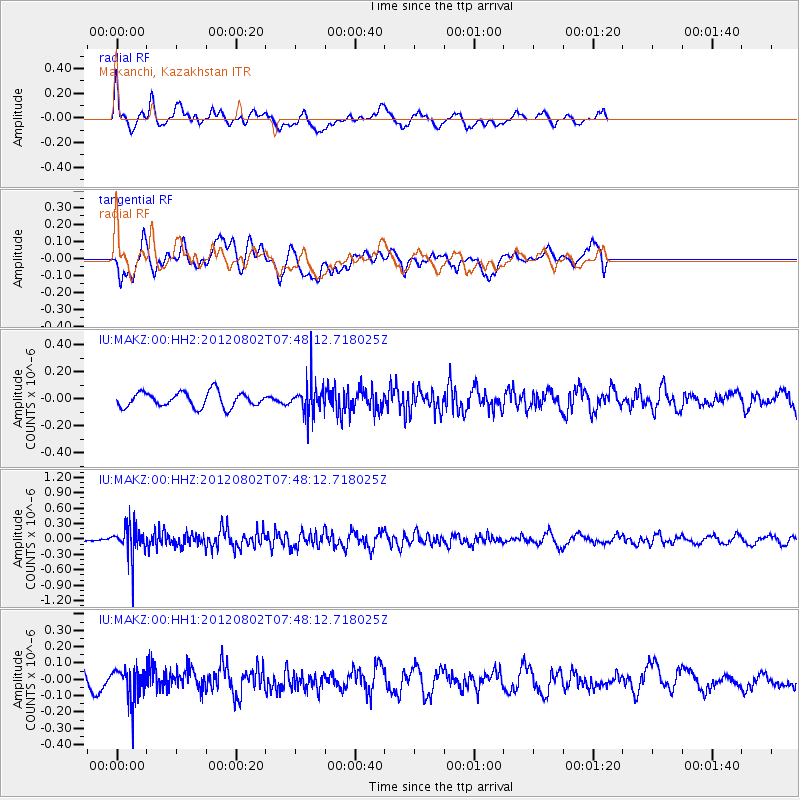
MAKZ Makanchi, Kazakhstan - Earthquake Result Viewer
*The percent match for this event was below the threshold and hence no stack was calculated.
| Earthquake location: |
Tanimbar Islands Reg., Indonesia |
| Earthquake latitude/longitude: |
-6.9/131.1 |
| Earthquake time(UTC): |
2012/08/02 (215) 07:37:45 GMT |
| Earthquake Depth: |
65 km |
| Earthquake Magnitude: |
5.5 MW, 5.5 MW |
| Earthquake Catalog/Contributor: |
NEIC PDE/NEIC PDE-W |
|
| Network: |
IU Global Seismograph Network (GSN - IRIS/USGS) |
| Station: |
MAKZ Makanchi, Kazakhstan |
| Lat/Lon: |
46.81 N/81.98 E |
| Elevation: |
600 m |
|
| Distance: |
69.0 deg |
| Az: |
326.18 deg |
| Baz: |
126.443 deg |
| Ray Param: |
$rayparam |
*The percent match for this event was below the threshold and hence was not used in the summary stack. |
|
| Radial Match: |
57.656834 % |
| Radial Bump: |
399 |
| Transverse Match: |
66.50698 % |
| Transverse Bump: |
400 |
| SOD ConfigId: |
558545 |
| Insert Time: |
2013-09-17 16:07:29.167 +0000 |
| GWidth: |
2.5 |
| Max Bumps: |
400 |
| Tol: |
0.001 |
|
Signal To Noise
| Channel | StoN | STA | LTA |
| IU:MAKZ:00:HHZ:20120802T07:48:12.718025Z | 4.6187387 | 3.04273E-7 | 6.587794E-8 |
| IU:MAKZ:00:HH1:20120802T07:48:12.718025Z | 2.6391265 | 1.04067645E-7 | 3.943261E-8 |
| IU:MAKZ:00:HH2:20120802T07:48:12.718025Z | 2.1941442 | 1.2029103E-7 | 5.4823666E-8 |
| Arrivals |
| Ps | |
| PpPs | |
| PsPs/PpSs | |


